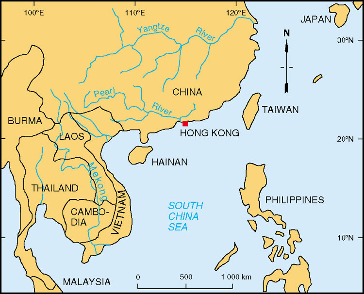
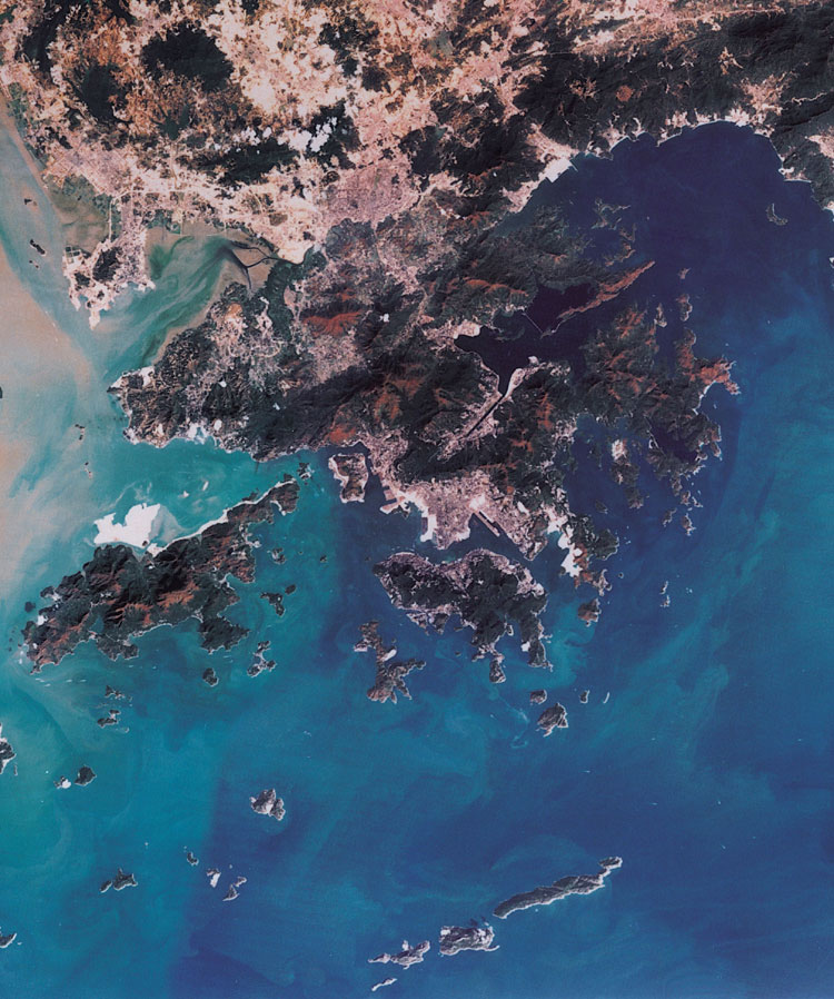
The Hong Kong Special Administrative Region (Hong Kong) is situated on the southern coast of China at the mouth of the Pearl River (Figure 1.1) . Hong Kong encompasses the New Territories, Kowloon, Hong Kong Island, Lantau Island and a total of 230 smaller islands. Of the total surface area (2755 km2) occupied by Hong Kong, approximately 40% (1104 km2) comprises land with the remainder covered by sea.
The topography of the area is rugged, comprising steep mountainous areas and deeply dissected valleys. The highest point is Tai Mo Shan (957 m) in the New Territories. Other high points include Victoria Peak (552 m) on Hong Kong Island, and Lantau Peak (934 m) on Lantau Island.
Hong Kong lies within the northern limits of the tropics and the climate is governed largely by the monsoons (Ramage, 1952). As a result, Hong Kong experiences a pronounced wet season in summer (May to mid-September), and a dry season in winter (November to February). The mean air temperature varies within a wide range of 13oC, from 15.6oC in January to 28.6oC in July (Chin, 1986). Such variation in rainfall and temperature has contributed to the presence of a deep weathering profile developed almost completely by chemical action (Fyfe et al., 2000).
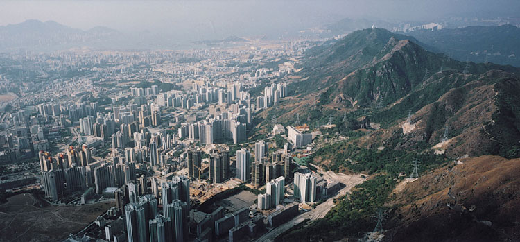
With a rapidly expanding urban community of more than six million people, land suitable for development is in short supply. Most of the population is concentrated in central Kowloon (Plate 1.1), Hong Kong Island, and the central New Territories, while new areas of development are being focussed in the northern New Territories and on Lantau Island. Such demand for land, within the limitations of the Hong Kong's natural landscape, has put increasing pressure on the need for a greater understanding of the nature of ground conditions and all other aspects of the onshore and offshore geology of the region.
The first geological survey of Hong Kong began in the 1920s and concluded with the publication by Brock et al. (1936) of the first geological map at 1:84 480 scale (0.75 inch to one mile). Further work in the 1940s (e.g. Williams et al., 1945) ultimately lead to the publication of the first memoir on the geology of Hong Kong by Davis (1952). Allen and Stephens (1971) produced two new geological map sheets at 1:50 000 scale, accompanied by a comprehensive geological report.
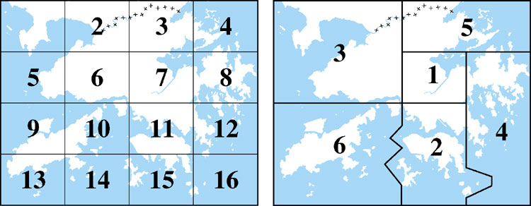
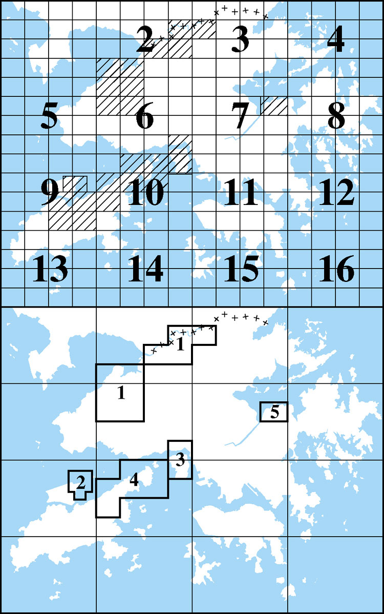
In response to a growing demand for more detailed geological information as the pace and scale of development in Hong Kong increased, a completely new geological survey was initiated in 1982. This resulted in the publication of 15 geological map sheets at 1:20 000 scale (GCO, 1986a, b; GCO, 1987; GCO, 1988b, c; GCO, 1989a, b, c & d; GCO, 1991a; GEO, 1991; GEO, 1992, GEO, 1994; GEO, 1995; GEO, 1996; Figure 1.2) and six accompanying memoirs (Addison, 1986; Strange & Shaw, 1986; Langford et al., 1989; Strange et al., 1990; Langford et al., 1995; Lai et al., 1996). During the latter period of this mapping project, specific geological problems were encountered in several new development areas. These necessitated detailed mapping at an even larger scale and 23 solid and superficial geological maps (Figure 1.3) were published at 1:5 000 scale, with five accompanying sheet reports (Frost, 1992; Langford, 1994; Sewell & James, 1995; Sewell & Fyfe, 1995; Sewell, 1996). As a consequence of the enormous volume of new data that became available, largely through ground investigation associated with major infrastructure projects, it was then considered appropriate to review and synthesize these data, and where necessary, to modify earlier interpretations in line with the current state of knowledge. This led to the publishing of two volumes of geological memoirs with accompanying 1:100 000 scale geological maps. The first volume (Sewell et al., 2000) dealt comprehensively with the Pre-Quaternary geology of Hong Kong (i.e. those rocks of Palaeozoic, Mesozoic and Tertiary age) while the second volume (Fyfe et al., 2000) described the Quaternary (Holocene and Pleistocene) geology of Hong Kong. In The Pre-Quaternary Geology of Hong Kong and The Quaternary Geology of Hong Kong, the reader is referred to the six geological memoirs listed above for additional site-specific geological details. Updating of the 1:20 000 scale maps on a GIS platform is currently in progress.
As technology has improved, it is now considered desirable to make the most up-to-date published information on the geology of Hong Kong available in an on-line format that will facilitate access by the local and international communities. The structure of this interactive geological memoir is client-centred and designed to meet the information needs of the target users - the general public as well as professionals. The main topics are categorized in such a way that users from various backgrounds can view the available geological information at different levels of details from simple and concise to complex and comprehensive. This interactive geological memoir concentrates mainly on the onshore solid and superficial geology of Hong Kong and is accompanied by relevant geological maps. This interactive geological memoir and the accompanying geological maps are created by C. W. Lee of the Geological Survey Section, Planning Division, and are first published on-line in 2006. Updated interpretations will be incorporated in this memoir as new information becomes available.
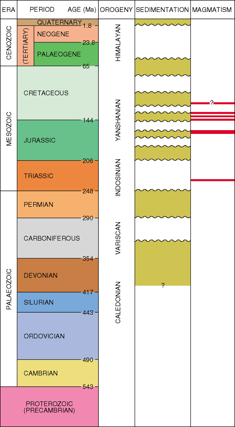
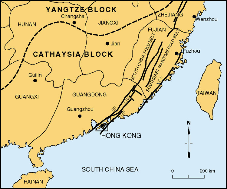
The present tectonic framework of East Asia is thought to be a consequence of multiple collisions among microplates (Chapter 2). These commenced in the Proterozoic and continued with the India - Tibet collision in the Cenozoic (Figure 1.4). Within this tectonic amalgam, southeastern China consists of a major structural element (the South China Block) comprising the Yangtze Block in the north and the Cathaysia Block in the southeast (Figure 1.5). Hong Kong lies entirely within the Lianhuashan Fault Zone (LFZ). This 30 km-wide zone of northnortheast- and east-trending faults is bounded to the north by the Shenzhen Fault and to the south by the Haifeng Fault. In the maritime provinces of Guangdong, Fujian, and Zhejiang, the LFZ separates the South China Fold Belt and the Southeast Maritime Fold Belt (or Fujian Coast Belt).
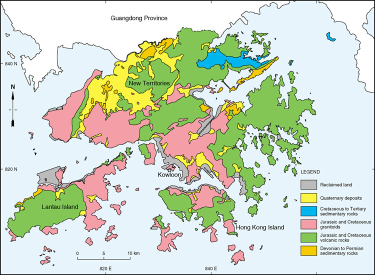
The oldest rocks in Hong Kong are Late Palaeozoic non-marine and shallow marine sedimentary rocks (Chapter 3). These Devonian, Carboniferous and Permian rocks crop out mainly in northeast and northwest Hong Kong (Figure 1.6) and comprise 10% of onshore rock exposures. A Triassic granite is present in subcrop offshore in the northwest of Hong Kong.
Jurassic sedimentary rocks (Chapter 4) are exposed over a small area of Hong Kong (<3%). They comprise Early and Middle Jurassic sandstones, siltstones and shales that were deposited in a deep marine shelf environment.
Mesozoic volcanic (Chapter 5) and plutonic rocks (Chapter 6) are the dominant rock types in Hong Kong, accounting for about 85% of rock outcrop on land. They comprise subvolcanic granite plutons, high level silicic dykes, and thick rhyolitic tuffs and lavas. Most of the igneous rocks are of Late Jurassic to Early Cretaceous age. The distribution and form of volcanic centres and related plutons are strongly controlled by eastnortheast-trending and northwest-trending faults (Chapter 7).
Mesozoic sedimentary rocks younger than the main volcanic episode, and Tertiary sedimentary rocks (Chapter 8) are exposed mainly in northeast Hong Kong. They comprise non-marine red bed and evaporitic sediments that were deposited in fault-controlled basins that subsided rapidly, then were uplifted.
Faults in Hong Kong (Chapter 9) form many of the major northeast-trending and orthogonal northnorthwest- trending valleys (Plate 1.2). Deformation, marked by folding and faulting, developed along periodically reactivated deep crustal structures. Microseismic activity continues to the present day on some of these faults.
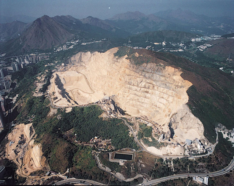
Various metallic and non-metallic minerals (Chapter 10) have been reported in Hong Kong. Quantities of metallic minerals are generally small and few deposits have been exploited commercially. However, several quarries (Plate 1.3) have provided aggregate. Three continue to do so, principally for concrete manufacture.
Weathering, mass movement, drainage and soil development, have shaped Hong Kong's present landscape and led to the accumulation of locally thick Quaternary superficial deposits. New land acquired through reclamation, which represents about 6% of the onshore area, has provided land for housing about 20% of the population. The distribution and nature of superficial deposits and the history of reclamation in Hong Kong are described in Chapter 11.
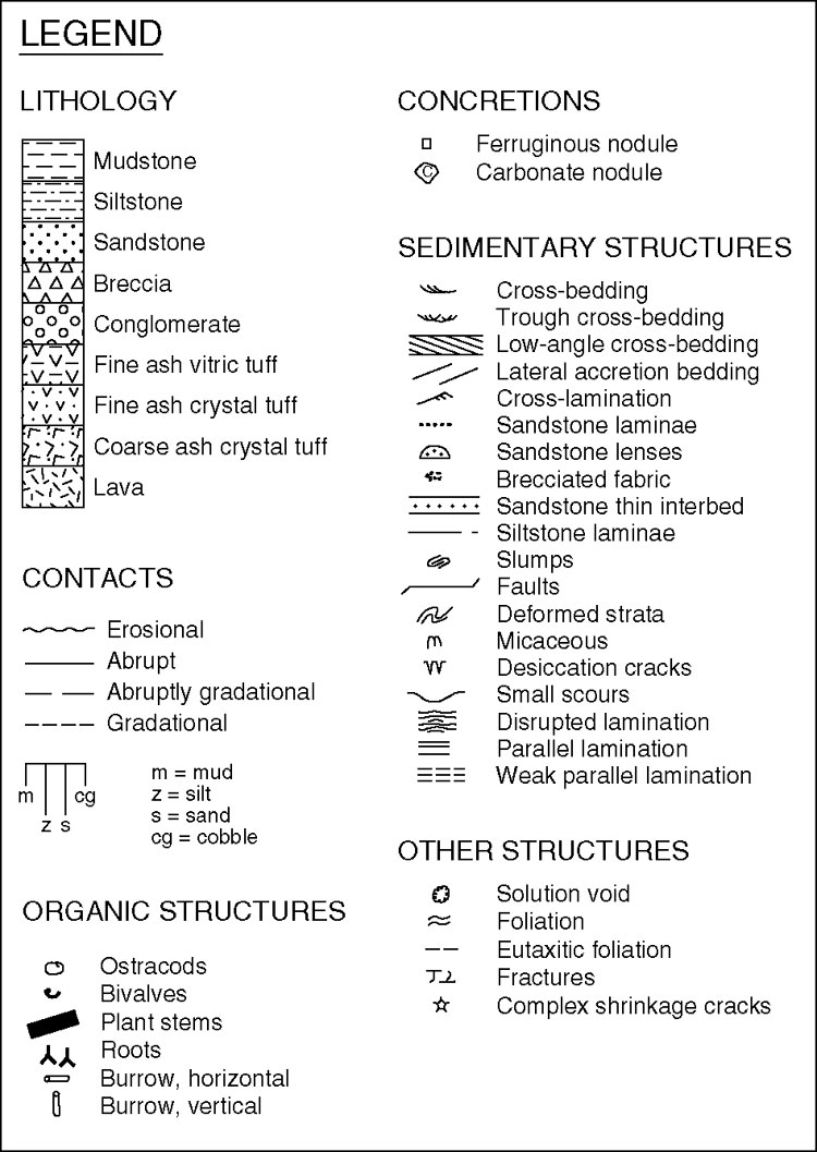
Unpublished geological data referred to in this volume can be consulted in the Civil Engineering Library, Civil Engineering and Development Department. Explanations of some of the more specialized expressions used are given in the glossary of terms. All heights are in metres above Principal Datum (mPD) and symbols used on the section logs are given in Figure 1.7. Place names are given in English, or their anglicized form, in the present English version of the interactive memoir. However, place names in both English and Chinese characters are given in some selected maps and a glossary of English and Chinese place names is also included for reference.
Disclaimer Notice:
The mapping information provided on this web site is protected by copyright owned by the Government of the Hong Kong Special Administrative Region (the "Government"). No express or implied warranty is given to the accuracy or completeness of such mapping information or its appropriateness for use in any particular circumstances. The Government is not responsible for any loss or damage whatsoever arising from any cause whatsoever in connection with such mapping information or with this web site.