- Geology of Yuen Long
- Geology of Chek Lap Kok
- Geology of Tsing Yi
- Geology of North Lantau Island and Ma Wan
- Geology of Ma On Shan
- Geology of Tung Chung and Northshore Lantau Island
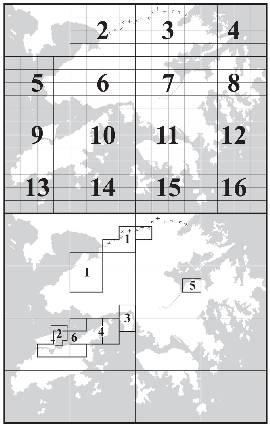
Beginning early in the 1990s, major new infrastructure projects and other schemes related to the Port and Airport Development Strategy (PADS) have required significant geological support. In 1988, to cope with the growing demand for detailed geological information, the HKGS embarked on a 1:5,000 scale mapping programme of main development areas. This was supported by a number of specialist projects. Over thirty maps and six sheet reports have now been published and the latter are available free on request from the Planning Division.
Sheet Report No. 1
Geology of Yuen Long by D.V. Frost, 1992, 69p., 24 figures, 2 tables, 16 plates. This report describes the solid and superficial geology of Scheduled Area No. 2 and surrounding areas in northwest New Territories. Scheduled Area No. 2 is defined as an area where the presence of marble containing cavities is possible at depth. The report is accompanied by 14 1:5,000-scale geological maps.
Sheet Report No. 2
Geology of Chek Lap Kok by R.L. Langford, 1994, 10 figures, 3 tables, and 31 plates. This report describes the solid and superficial geology of the former island of Chek Lap Kok, prior to development of the new airport. The geology of Chek Lap Kok is dominated by Mesozoic granite which has been cut by a swarm of feldsparphyric rhyolite dykes. The report is accompanied by 1:5,000 geological map Sheet 9-NE-C/D.
Sheet Report No. 3
Geology of Tsing Yi by R.J. Sewell and J.A. Fyfe, 1995, 13 figures, 3 tables, 15 plates. 43p. This report describes the geology of Tsing Yi and surrounding offshore area, and is covered by the 1:5,000 map sheets 6-SE-B and 10-NE-B,D. The geology is dominated by Mesozoic granites and volcanic rocks which are intruded by an E-W oriented feldsparphyric rhyolite dyke swarm. Minor exposures of volcaniclastic sedimentary rocks are found in the northern part of the island.
Sheet Report No. 4
Geology of North Lantau Island and Ma Wan by R.J. Sewell and J.C.W. James, 1995, 11 figures, 3 tables, 16 plates, 46p. This report describes the geology of north Lantau Island and Ma Wan, and should be read in conjunction with 1:5,000 geological map sheets 10-NE-A, 10-NE-C, 10-NW-B, 10-NW-C, 10-NW-D, and 10-SW-A. The rocks of the area are composed dominantly of Mesozoic granites and volcanic rocks which have been intruded by a strongly ENE-WSW oriented feldsparphyric rhyolite dyke swarm.
Sheet Report No. 5
Geology of Ma On Shan by R.J. Sewell, 1996, 14 figures, 3 tables, and 12 plates, 45p. This report describes the onshore geology of the area covered by Sheet 7-NE-D and part of Sheet 7-NE-C located on the south side of Tolo Harbour in the New Territories. The area covers part of the Scheduled Area No. 4 of the Ma On Shan Reclamation where the presence of marble containing cavities is possible at depth. The geology of the area comprises sedimentary rocks of Late Palaeozoic and Mesozoic age, and granites and volcanic rocks of Mesozoic age.
Sheet Report No. 6
Geology of Tung Chung and Northshore Lantau Island by R.J. Sewell & P.A. Kirk, 2002, 17 figures, 3 tables, 8 plates and one Appendix, 90p. This report describes the geology of northern central Lantau Island, with special reference to complex ground conditions at Tung Chung New Town, and offshore areas along the North Lantau coast between Chek Lap Kok and Yam O. The report includes an appendix comprising a lexicon of terms used for drillcore logging and surface mapping at Tung Chung, and should be read in conjunction with the 1:5 000-scale Geological Maps 9-SE-A and 9-SE-B (revised 2002), and parts of three 1:5 000-scale geological map sheets previously described within the scope of Sheet Report No. 4. The geology of the area comprises sedimentary, volcanic and intrusive rocks of Mesozoic age.