
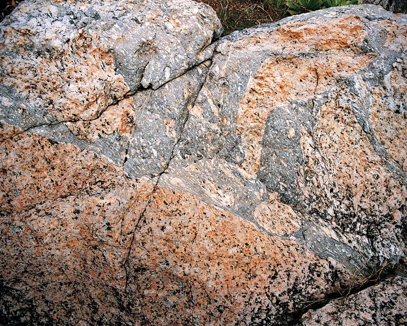
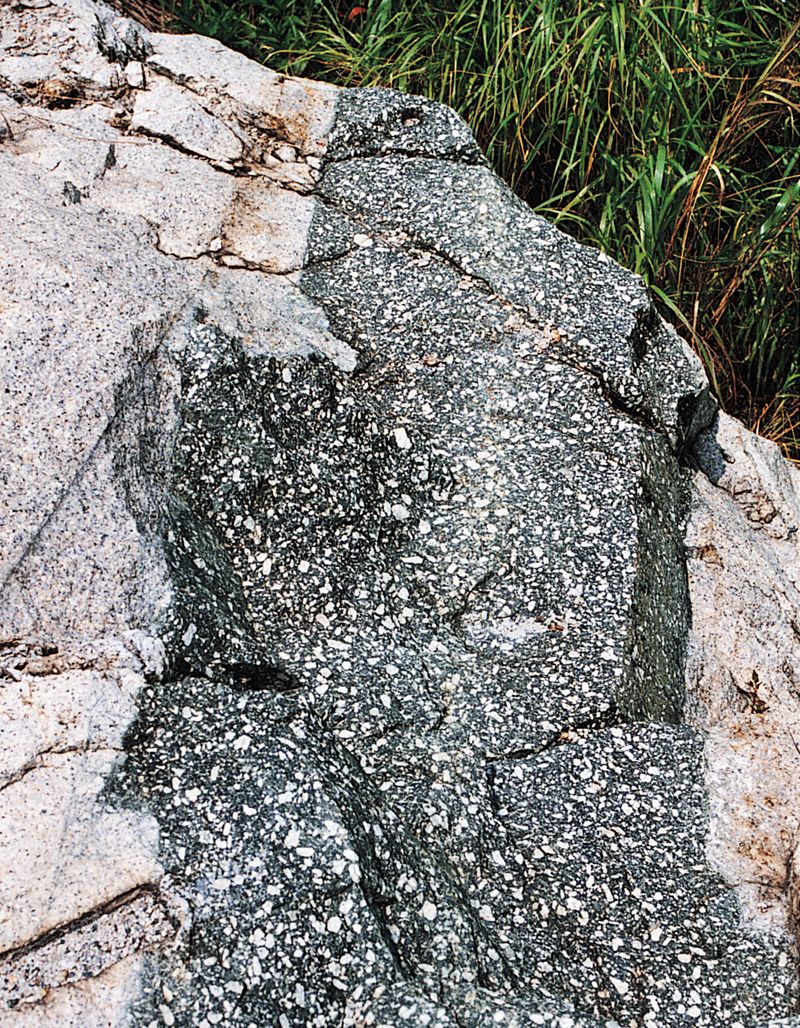
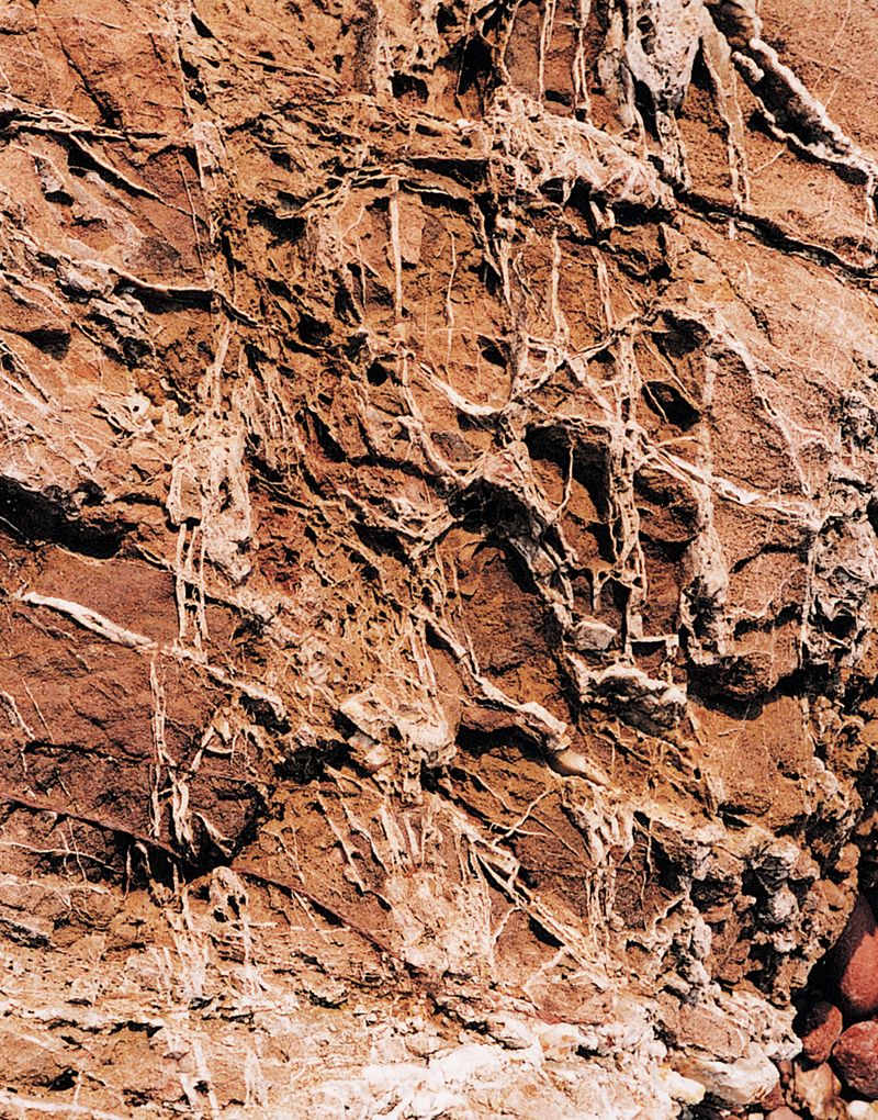
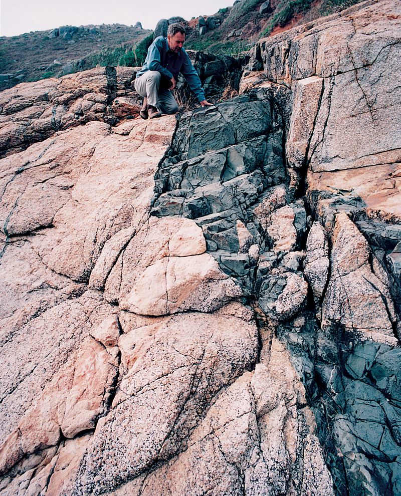
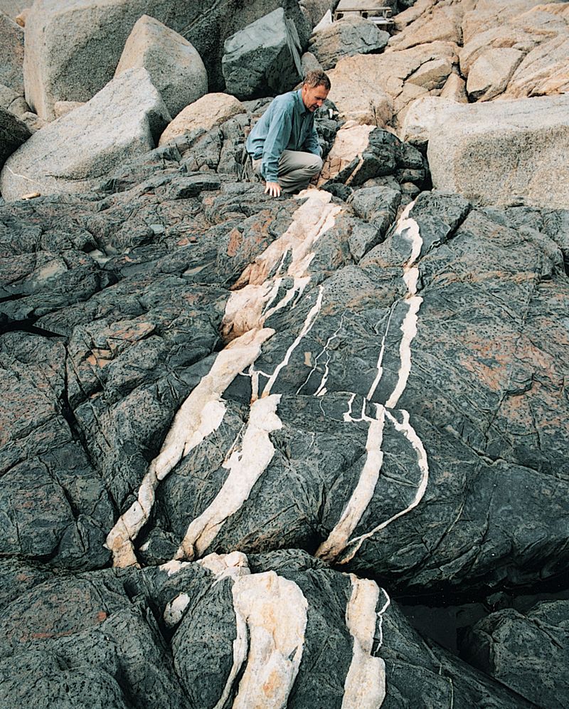
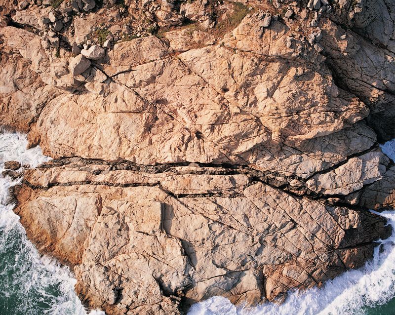
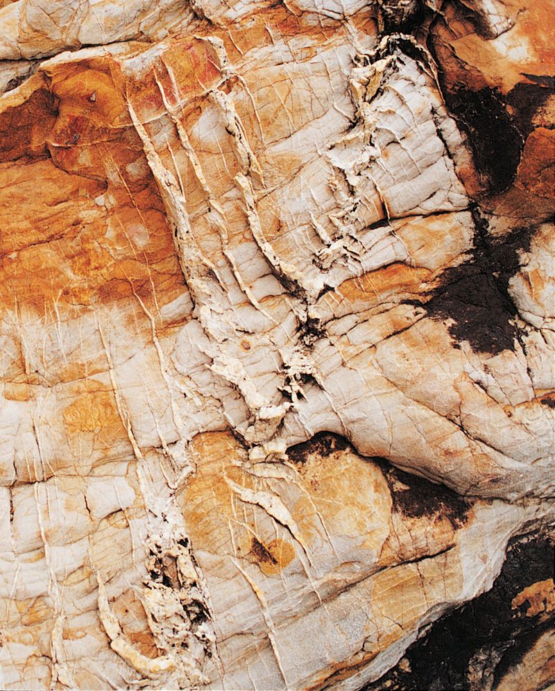
南丫島厓頭細粒淺灰色岩石侵入中粒粉紅色花崗岩的近觀
Close-up of medium-grained pink granite at Ngai Tau, Lamma Island, intruded by a fine-grained, light grey rock.
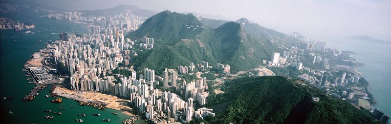
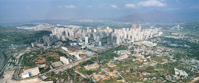
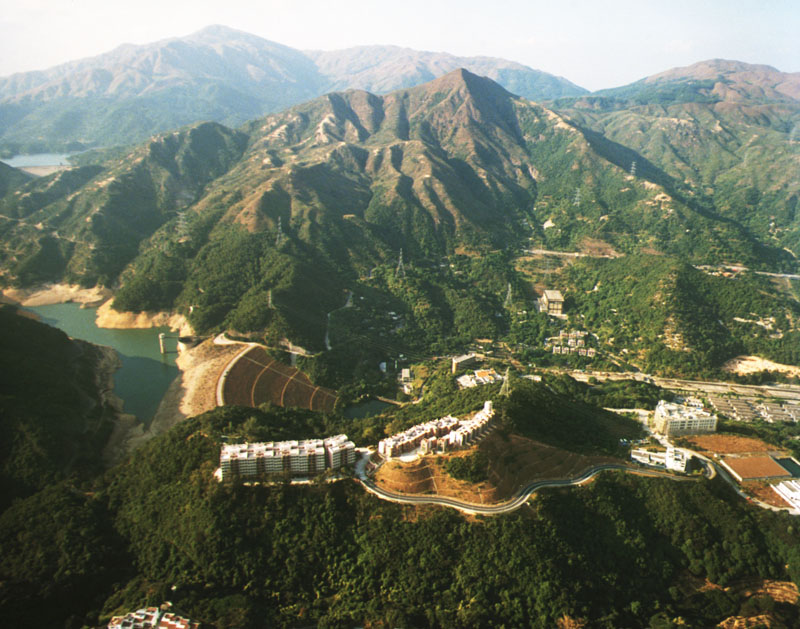
九龍的平地由風化花崗岩組成,北部的山脈由堅硬的火山岩和花崗岩形成。
The low-lying area of Kowloon, composed of weathered granite, is flanked to the north by a ridge of resistant volcanic rock and granite."
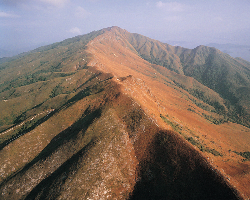
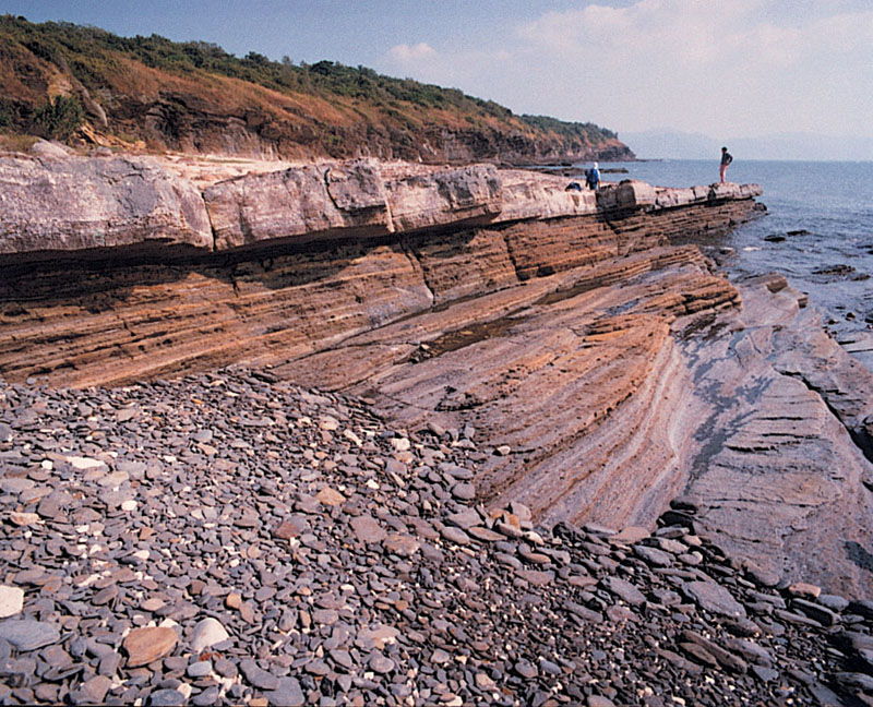
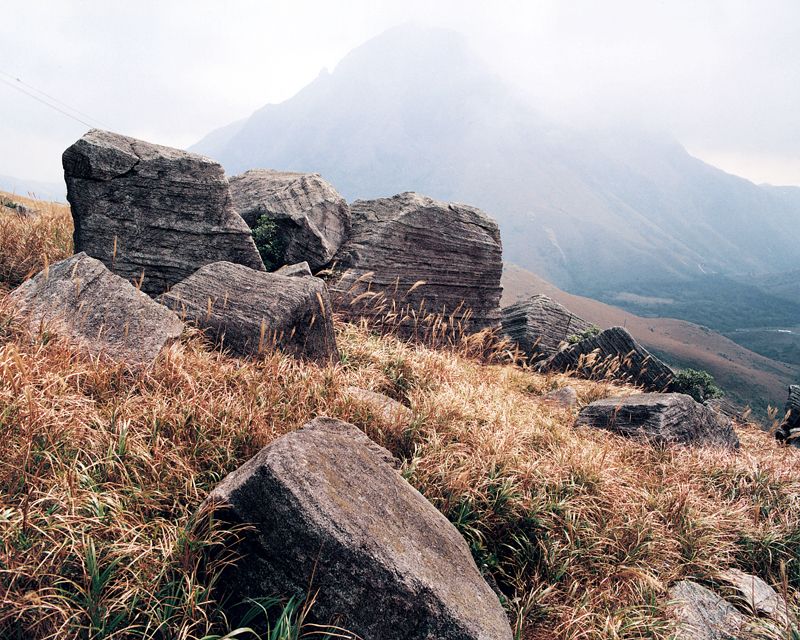
八仙嶺上沿八仙嶺徑,嶺分雙翼,左翼一瀉千丈,右翼伸延廣闊,氣勢磅礴。嶺上的岩石原是一億年前河床的砂礫。
A gorgeous mountain range formed by tilted layers of sedimentary rocks along the Pat Sin Leng Trail, which creates a steep cliff on one side, and a gentle slope on the other. The rocks comprise boulders and cobbles carried along with sand and silt in rivers 100 million years ago.
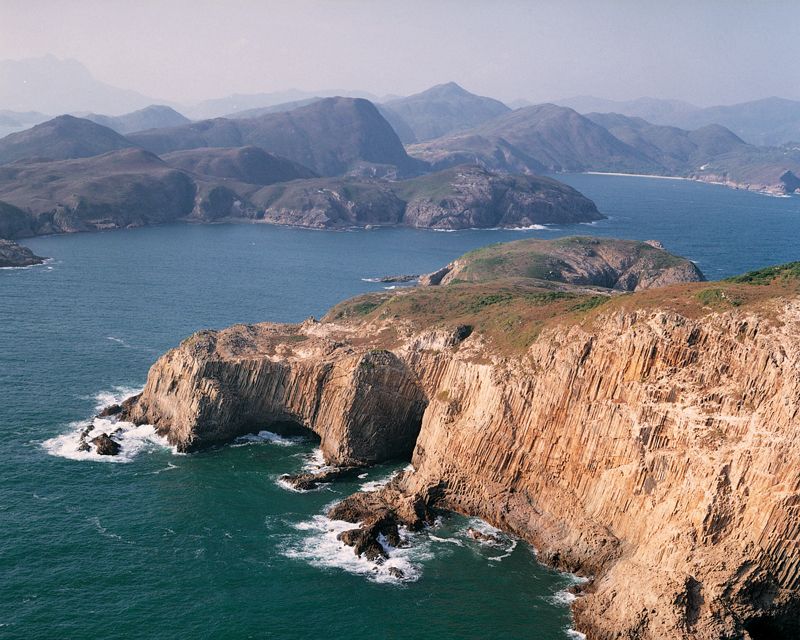
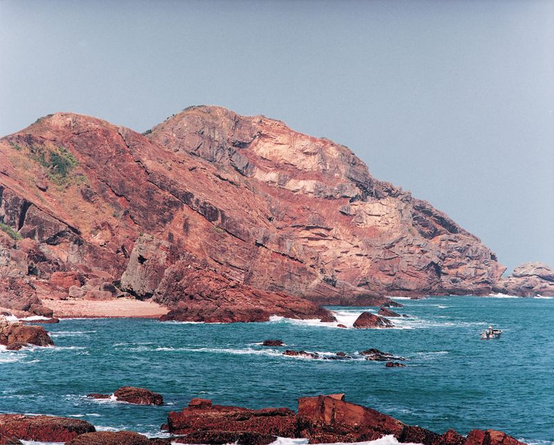
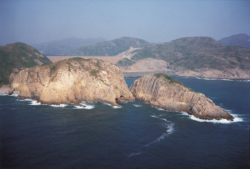
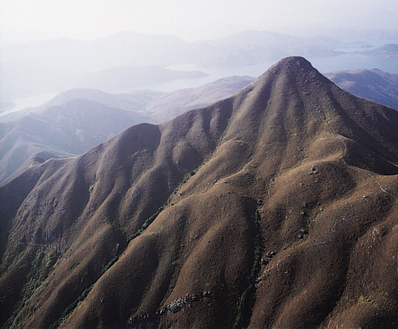
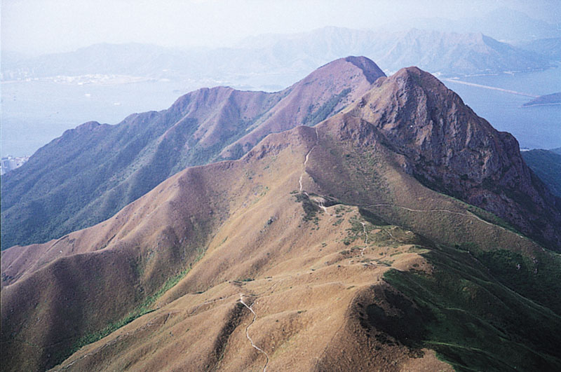
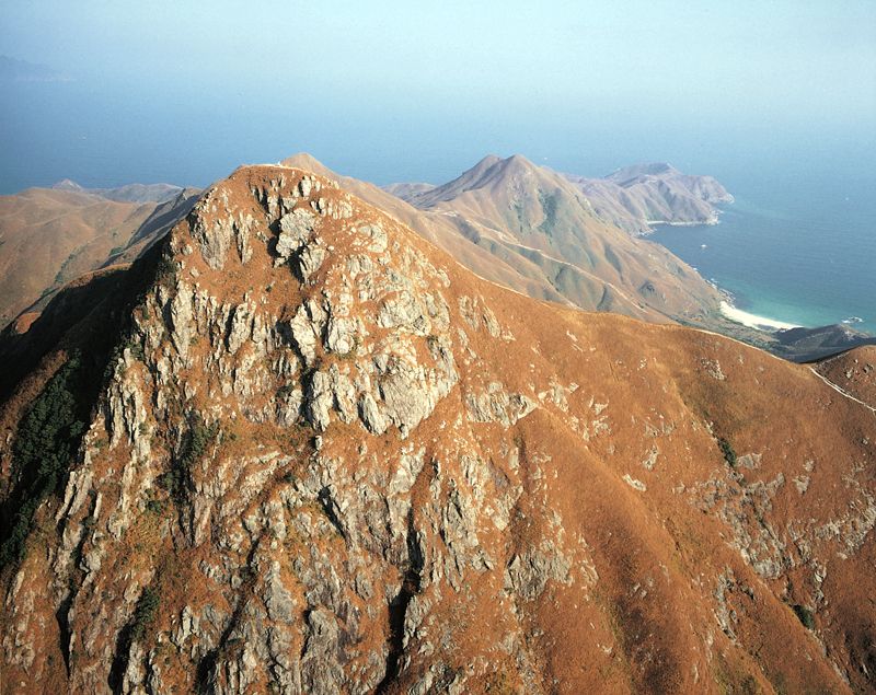
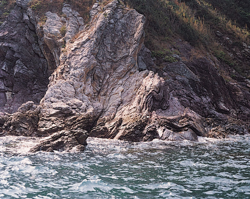
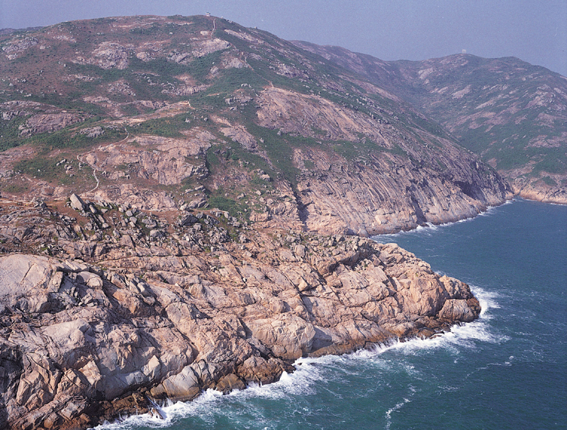
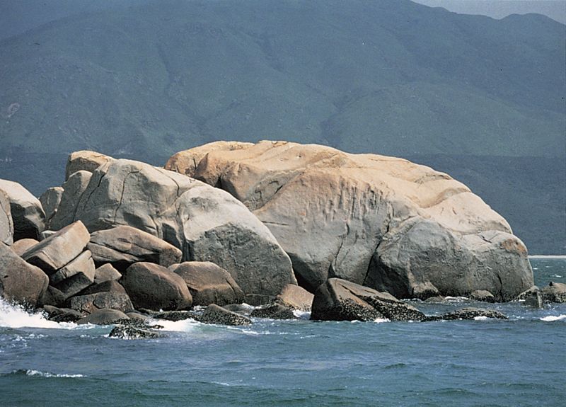
新界東大浪灣及遠處的蚺蛇尖山峰。
Sharp Peak and the coast at Tai Long Wan, eastern New Territories.
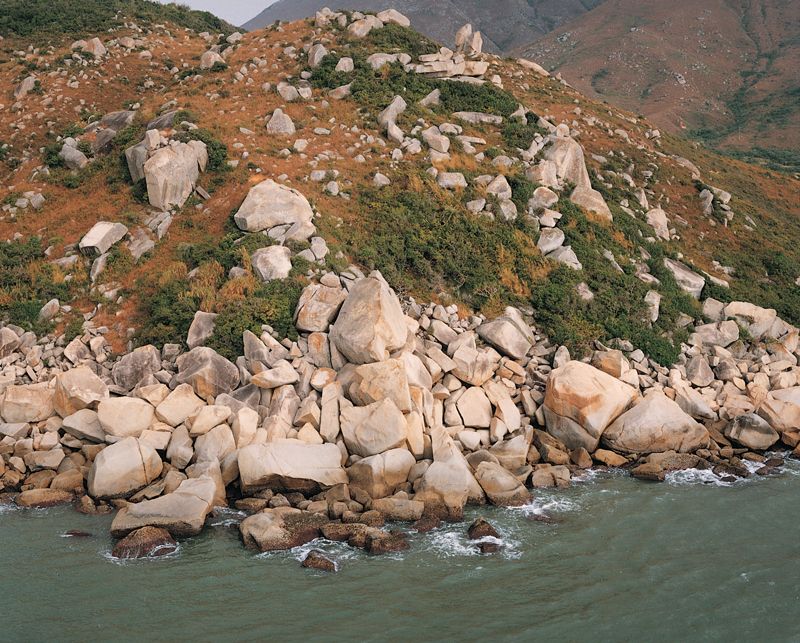
索罟群島大鴉洲花崗岩的小山包散佈着巨大礫石,並在山腳形成巨礫堆。
A pile of loose boulders at the base of a low hill topped by granite tors on Tai A Chau, Soko Islands.
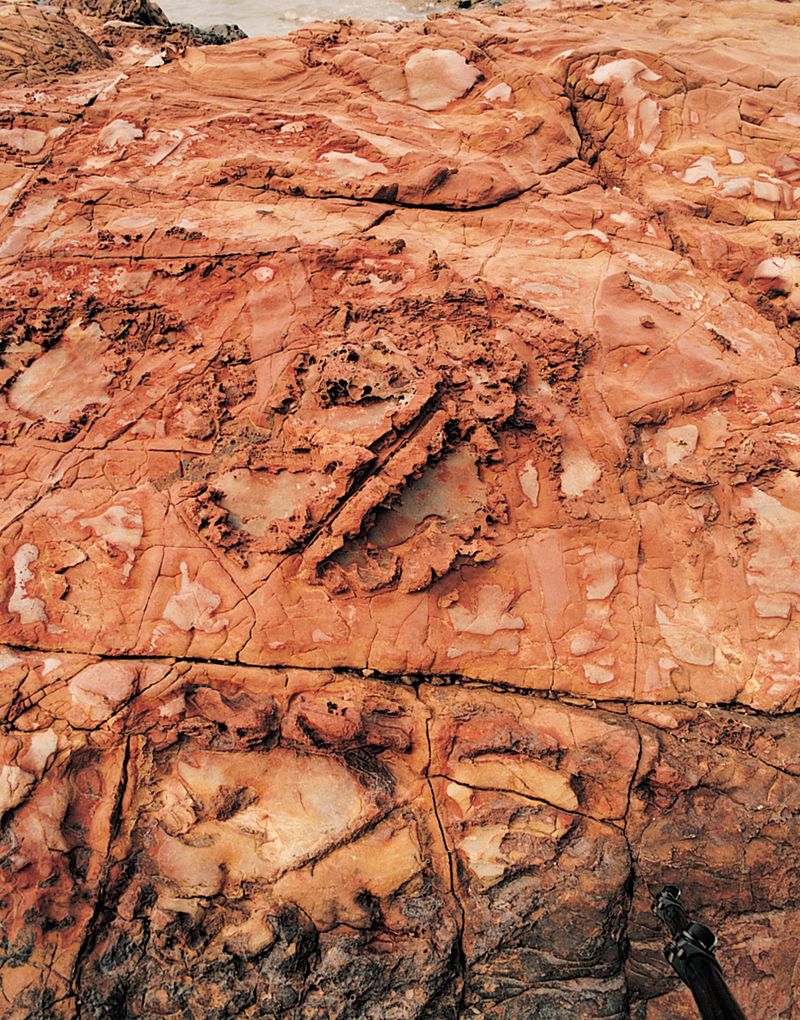
風雨萬千年,但大澳的拱形石英砂岩柱仍然頑強地屹立不倒。
A quartz sandstone arch in Tai O stubbornly resists the perennial onslaught of weathering and erosion.
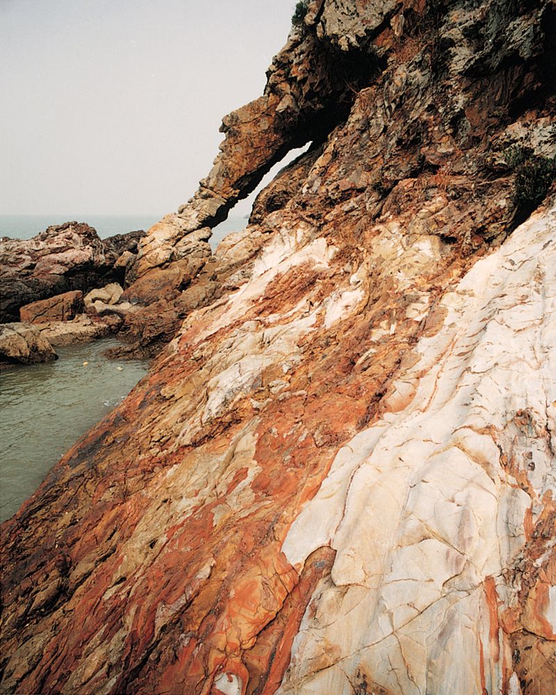
大嶼山大澳砂岩面上的紅色鐵銹斑。
Red iron staining in sandstone at Tai O, Lautau Island.
大嶼山愉景灣附近一條富含斑晶,具不規則和整齊邊緣的岩牆。
A crystal-rich dyke with irregular and straight margins near Discovery Bay, Lantau Island.
西貢海東面的大鏟洲上,鐵銹色的岩石裂隙,灰和深灰色的泥岩,仿如一幅抽象派的油畫。
This masterpiece of abstract painting occurs on Tai Tsan Chau, Eastern New Territories, where iron-stained joints cross dark and light grey layers of mudstone.
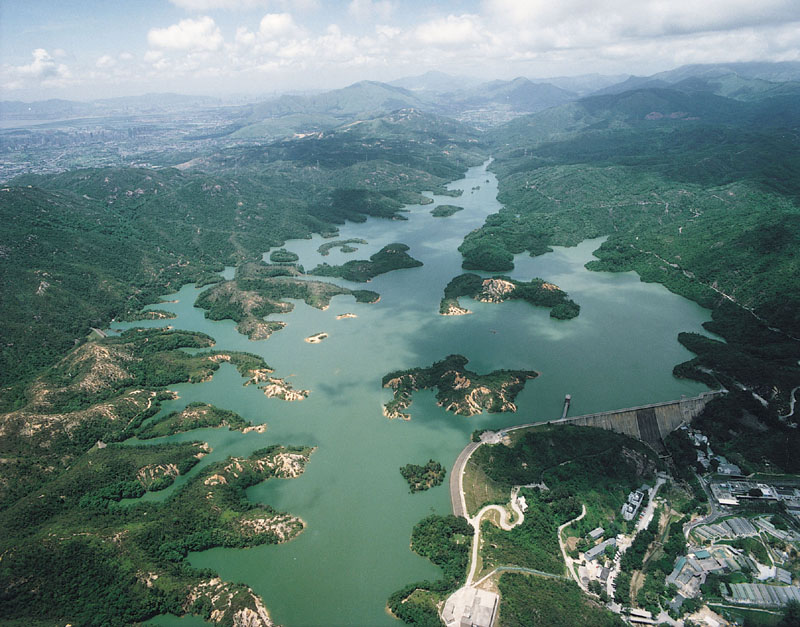
大欖涌水塘位於大欖斷層上,圖片遠方為斷層的東北方向。
Looking northeast along the strike of the Tai Lam Fault, western New Territories.
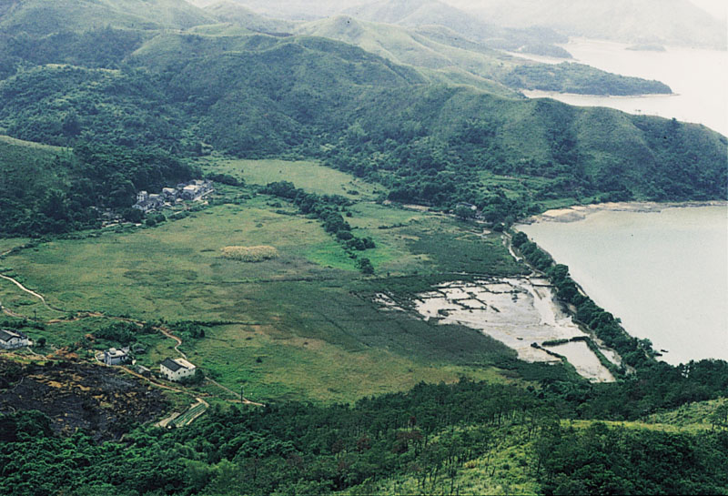
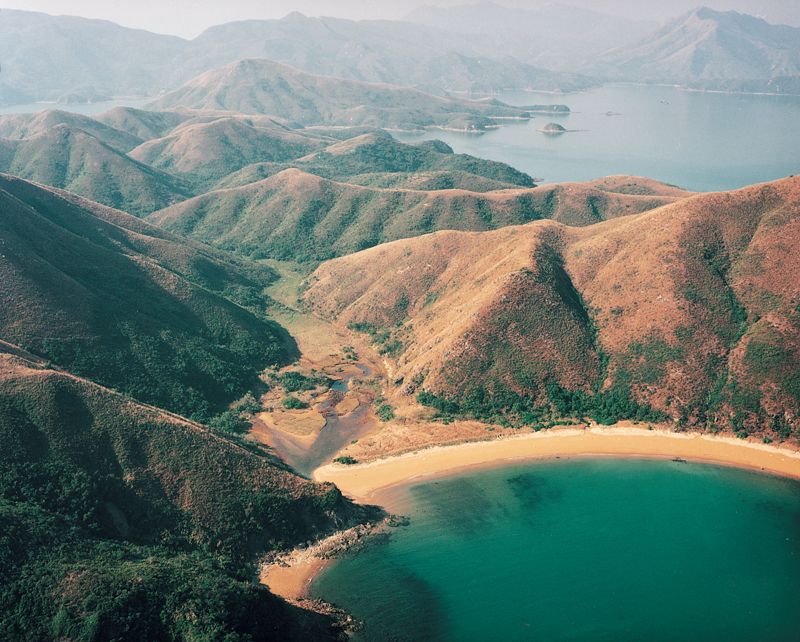
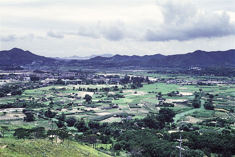
元朗是在一個寬廣肥沃的河流泛濫平原和潮泥灘上填土而成。
Yuen Long is built on a wide, fertile river flood plain and reclaimed mudflats.
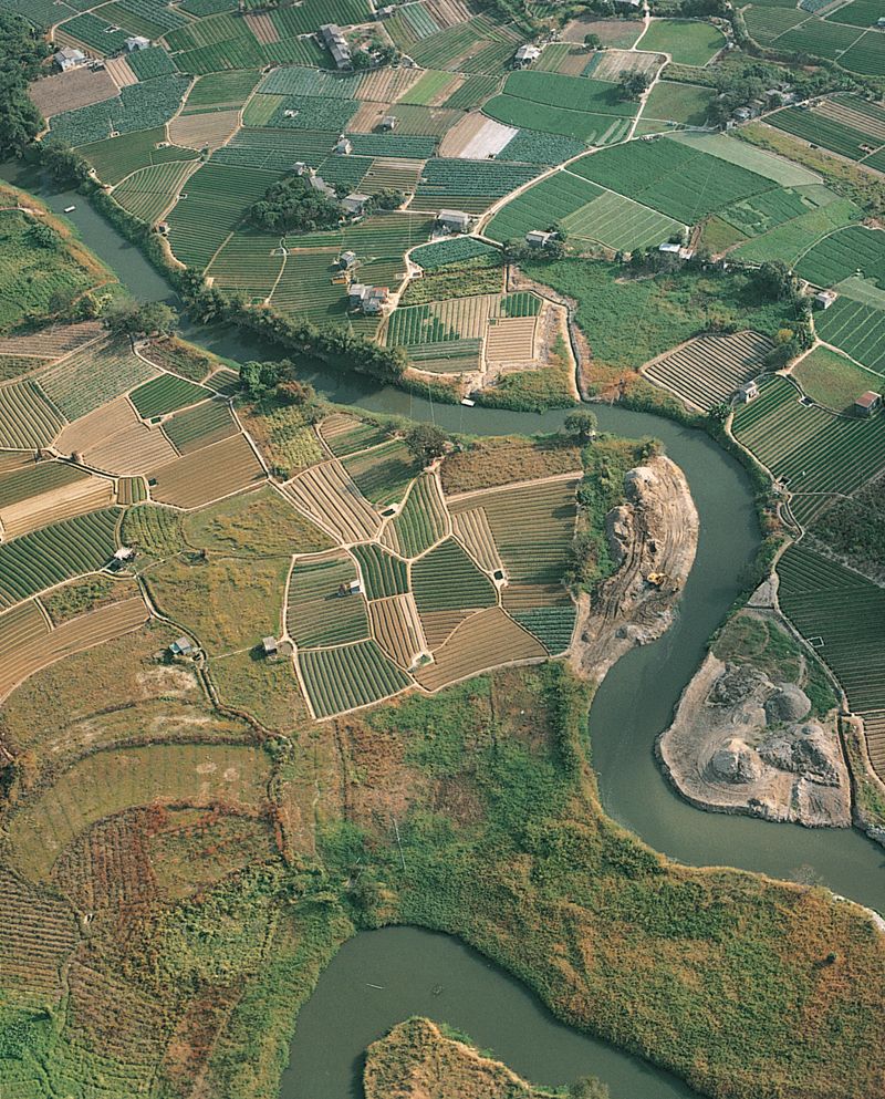
元朗平原上的曲流河道。
Sweeping curves of a meandering stream on the Yuen Long plain.
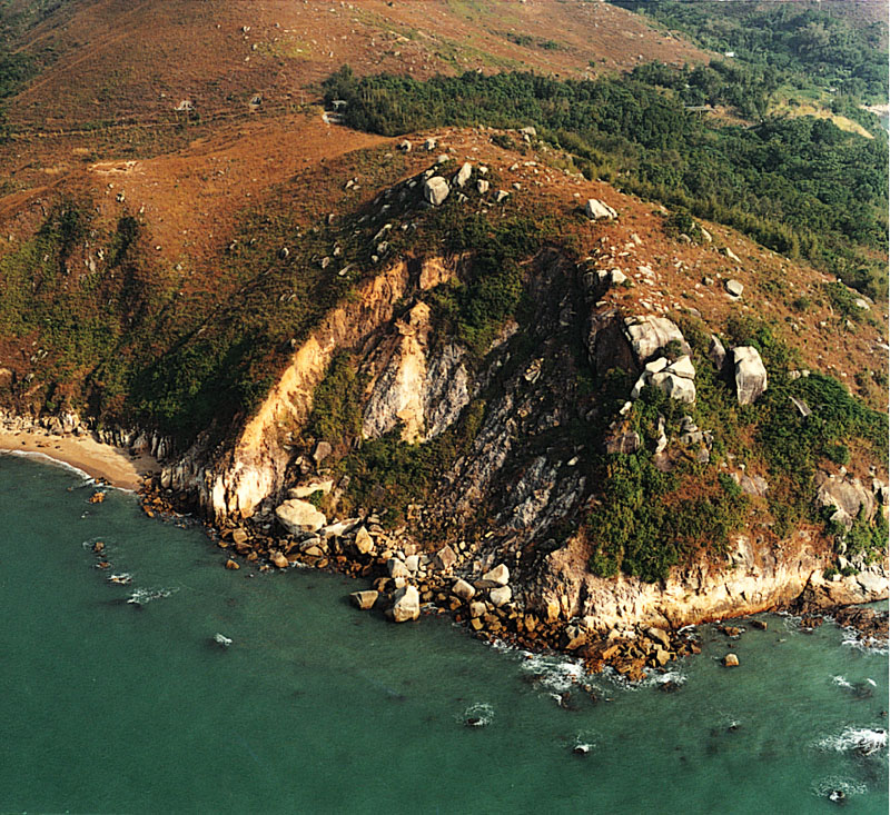
大嶼山分流半島的花崗岩矮崖;背景群山為火山岩。
Low granite cliffs on the Fan Lau peninsula, Lantau Island; the higher hills in the background are composed of volcanic rock.
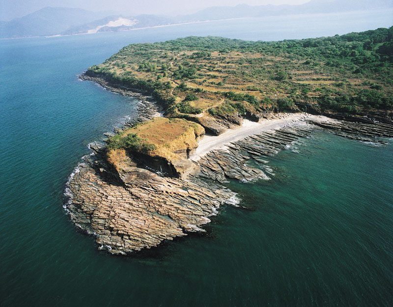
北果洲岩石屬白堊紀糧船灣組,形成巨大的柱狀節理。
The tops of columnar joints in the High Island Formation, North Nine Pin Island.
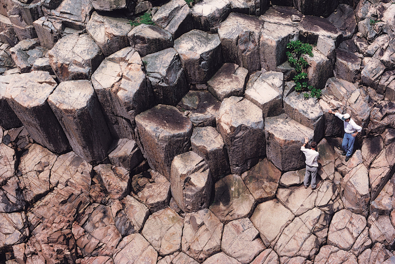
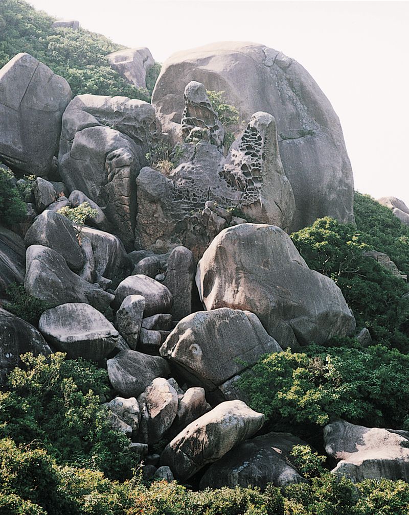
北果洲群島上貌似蜂巢的六角石柱奇景,是一億四千萬年前西貢附近火山猛烈爆發後,火山灰冷卻和收縮後形成的傑作。
Resembling the honeycomb of giant bees, cooling and shrinkage of hot volcanic ash formed these spectacular six-sided columns on North Ninepin Island, after a volcano near Sai Kung erupted violently about 140 million years ago.
果洲群島上六邊形柱狀節理的近觀。
Close-up of the six-sided columns on the Nine Pin Islands.
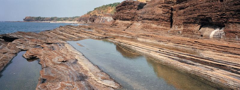
新界東部平洲島上的薄層狀粉砂岩和泥岩,線條優美,是寫意攝影家流連忘返之地。這些薄層狀、色調優美、微微傾斜的岩石是在億萬年前在湖底沉積形成。
The flowing lines of Ping Chau's rock platforms are a great attraction for enthusiasts of landscape photography. The thin layers of delicately coloured and gently tilted rocks were deposited as mud and silt on the bottom of a lake.
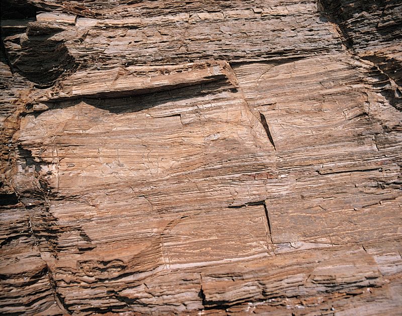
平洲岩層近觀:每個薄層代表形成於每一年的沉積。
Close-up of extremely thin rock layers on Ping Chau; each layer was deposited in a single year.
平洲島的平洲組岩層主要是由薄層的粉砂岩組成,局部地方夾有淺色的厚層燧石,圖片中燧石層向海傾没,故有「龍落水」的稱號。
Light-coloured chert beds within thinly-bedded red siltstone of the Ping Chau Formation, Ping Chau.
平洲海蝕平台。
Wave-cut platform, Ping Chau.
在赤門海峽白沙頭洲可以見到白色石英礫岩和砂岩。這是由四億年前河流泛濫平原上的砂礫形成。
Sand and gravel carried by a river onto a vast floodplain 400 million years ago were transformed into sandstone, with cobbles of white quartz, now found on Harbour lsland, Tolo Harbour.
荃灣石龍拱附近含有稜角狀岩塊的火山岩。
Presence of angular blocks in a volcanic rock near Shek Lung Kung.
新界東部伙頭墳洲具柱狀節理火山岩中的海蝕崖和海蝕洞。
Steep cliffs and narrow caves in columnar-jointed volcanic rocks on Fu Tau Fan Chau, eastern New Territories.
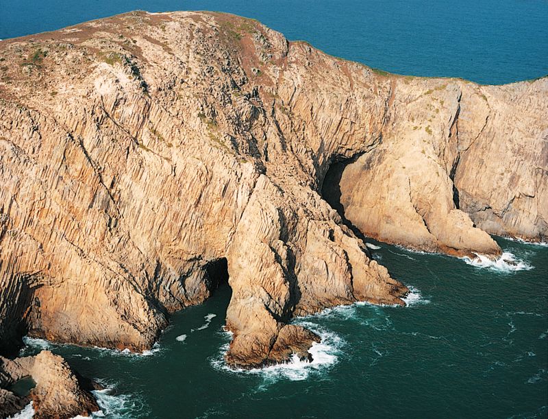
新界東部伙頭墳洲上的海蝕拱。
Sea arches on Fu Tau Fan Chau, eastern New Territories.
伙頭墳洲細齒狀的海岸線。
Highly indented section of coastline, Fu Tau Fan Chau (Town Island), eastern New Territories.
新界東北的吉澳洲,島上的山陵有斷層通過,斷層受風化侵蝕形成顯著的凹口。
Eroded fault forming a distinctive notch in the ridge line at the eastern end of Kat O Chau, northeastern New Territories.
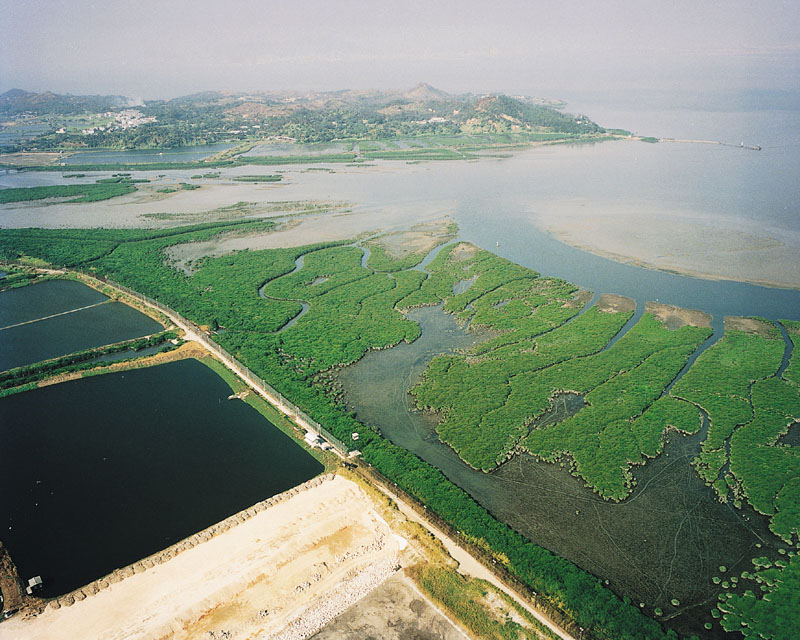
后海灣潮泥灘的紅樹林及潮水道。
Mudflats with mangroves, and tidal channels, Deep Bay.
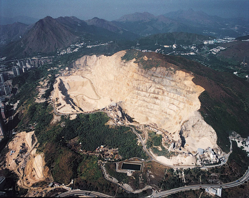
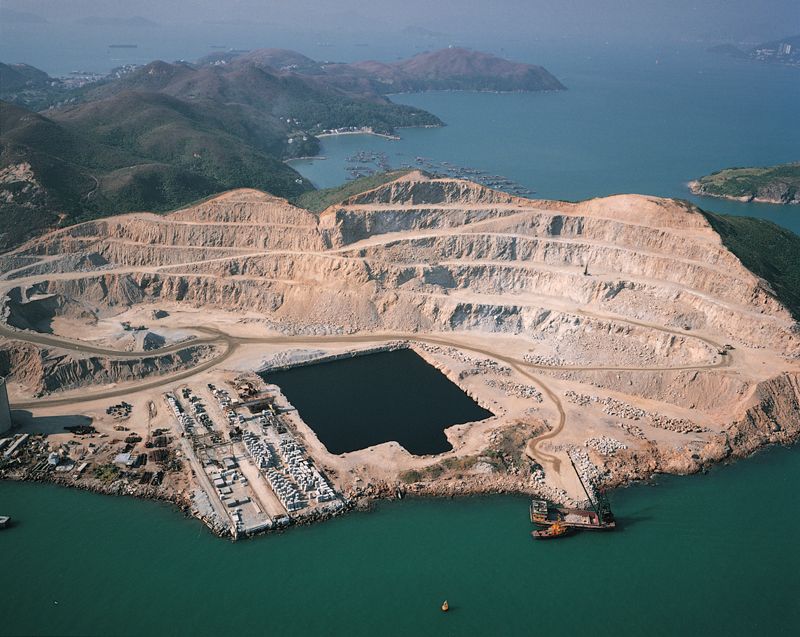
東九龍大上托西面的安達臣道石礦場。
Anderson Road quarry in eastern Kowloon on the western flanks of Tai Sheung Tok.
大嶼山老虎頭附近山頂上花崗岩的風化岩塊。
Weathered blocks of granite on a hill top near Lo Fu Tau, Lantau Island.
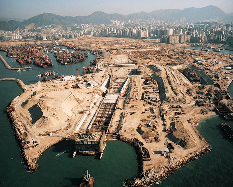
西九龍大型填海區。
Large reclamation platform in west Kowloon.
宋崗島花崗岩體的複合基質及長英質帶狀岩牆。
Composite mafic-felsic (dark rock) dyke, Sung Kong Island.
香港島西面的火山岩遠高於埋在維多利亞港下面的風化花崗岩。
Upstanding volcanic rocks of western Hong Kong Island overshadow the weathered granites that underlie Victoria Harbour.
平洲更樓石殘留的海蝕柱。
Remnants of old sea stacks at Kang Lau Shek, Ping Chau.
新界東北谷埔的河川及河口沉積地層。
Alluvial and estuarine deposits, Kuk Po, northeast New Territories.
赤洲紅色礫岩中的礫石和卵石是由火山岩、泥岩、砂岩和石英組成。
Red conglomerate on Port Island composed of boulders, cobbles and gravel of volcanic rock, mudstone, sandstone and quartz.
赤洲陡崖上傾斜的紅色砂岩、泥岩和礫岩岩層。
Tilted, layers of red sandstone, mudstone and conglomerate form the cliffs around Port Island.
赤洲紅色砂岩中的網狀方解石脈。
Network of calcite veins in red sandstone on Port Island.
赤洲一系列受侵蝕的海蝕柱。
A row of eroded sea stacks on Port Island.
新界東北部往灣洲狹窄的河流沖積平原和相連的海灘。
Narrow river plain and crescent-shaped beach on Double Island, northeastern New Territories.

大嶼山昂坪的厚層火山岩。
Resistant layers of volcanic rock at Ngong Ping, Lantau Island.
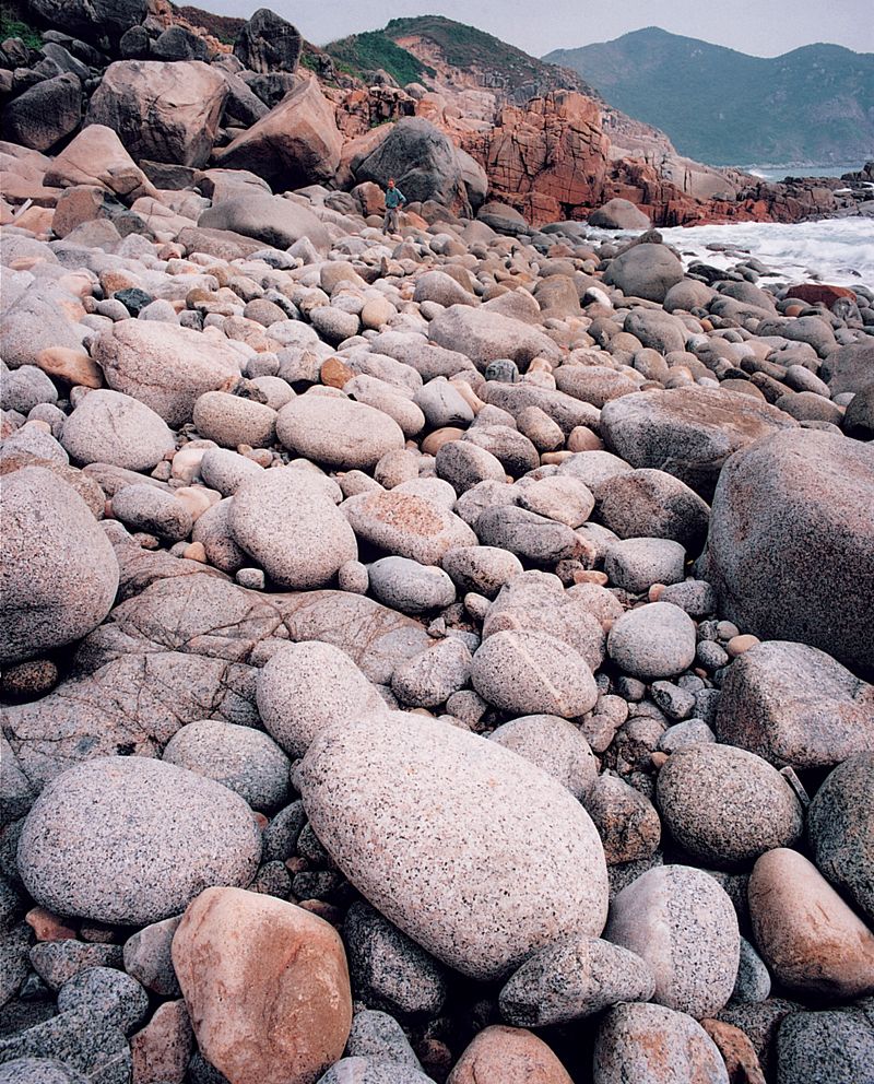
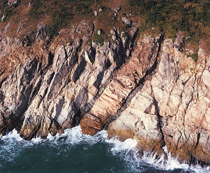
「浪淘盡,千古風流人物。」萬千年來的海浪亦淘盡了南丫島東澳灣上的花崗亂石,成為奇趣的大石卵。
Rounded boulders of granite buffeted by waves form a storm beach at Tung O Wan, Lamma Island. The beach was created by strong waves that have eroded the granite coastline.
長洲兩個花崗岩小島由沙洲連結起來。
Two low granite islands connected by a sandy beach, Cheung Chau.
青山附近風化花崗岩中的陡峭沖溝。
Steep erosion gullies in weathered granite, near Castle Peak.
新界西部青山地區遭受強烈風化的花崗岩山丘。
Deeply weathered and eroded granite hills in the Castle Peak area, western New Territories.
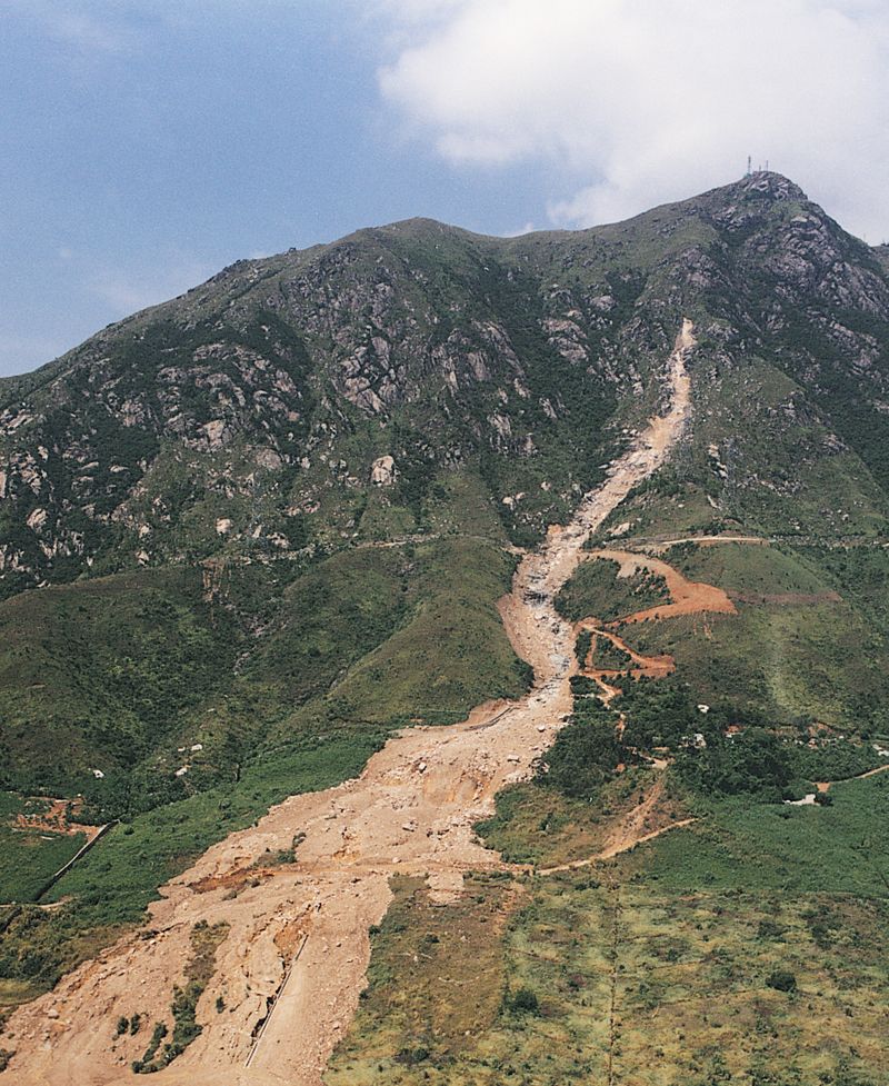
新界西部青山的大型滑坡。
Major landslide trail below Castle Peak, western New Territories.
新界東北部青洲的海蝕平台鳥瞰。
Bird's eye view of the wave-cut platform surrounding Tsing Chau, northeastern New Territories.
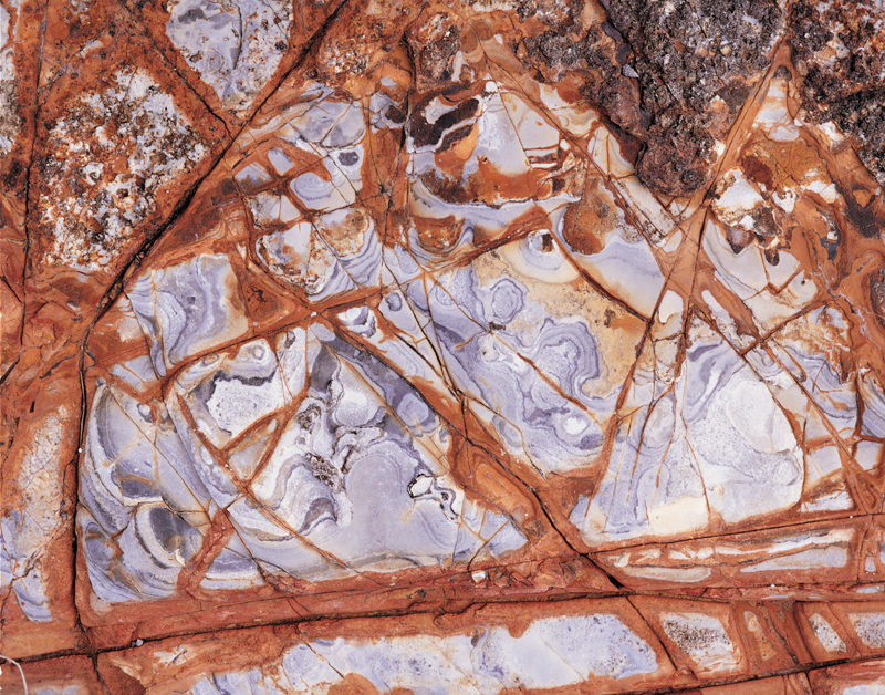
不規則的石英脈在南丫島上留下了像中國草書的字體。
Irregular quartz veins at this site on Lamma Island simulate the flowing characters of ancient Chinese calligraphy.
南丫島東北海岸的天然山坡崩塌。
Coastal landslide, northeast Lamma Island.
南丫島上不規則的石英脈。
Irregular quartz veins on Lamma Island.
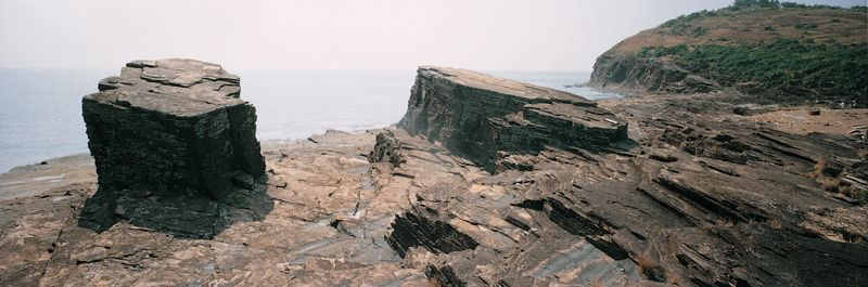
屏風山的懸崖表面由多層與崖頂平行的砂岩層組成。
Cliff face at Ping Fung Shan created by dipping layers of sandstone that lie parallel to the ridge top.
新界西北流浮山的后海灣斷層,斷層面以高角度向西北方傾斜。
Deep Bay Fault dipping steeply towards the northwest, Lau Fau Shan, northwestern New Territories.
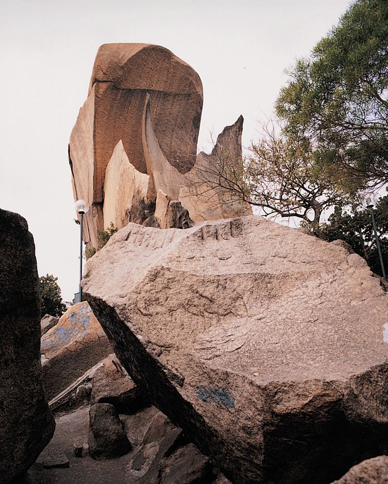
大自然的無形之手,為九龍土瓜灣海心公園留下這座奇異的雕塑。風雨侵蝕使花崗石表層像剝洋蔥般逐片剝落。
The invisible hand of nature created this beautiful granite sculpture at Hoi Sham Park, To Kwa Wan, Kowloon.
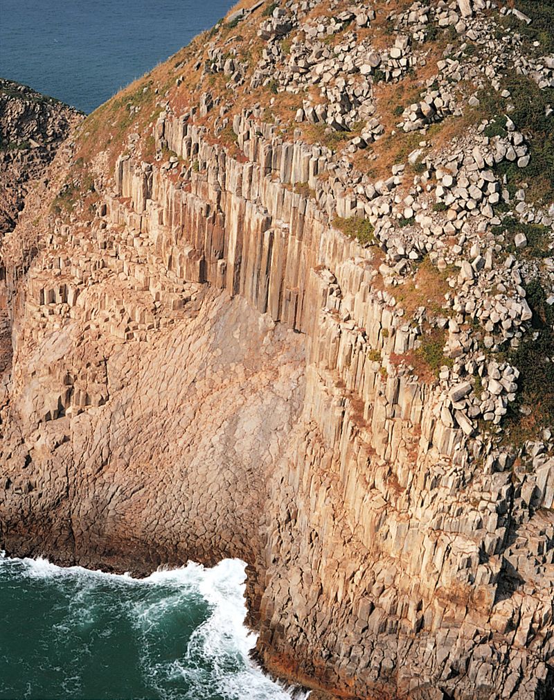
新界東萬宜水庫東邊懸崖出露的柱狀節理。
Columnar jointing in the cliffs east of High Island Reservoir, eastern New Territories.
粉嶺平原上的全新世河川冲積層。
Holocene river plain sediments (alluvium), Fanling Plain.
南丫島索罟灣的花崗岩石礦場。
Granite quarry at Sok Kwu Wan, Lamma Island.
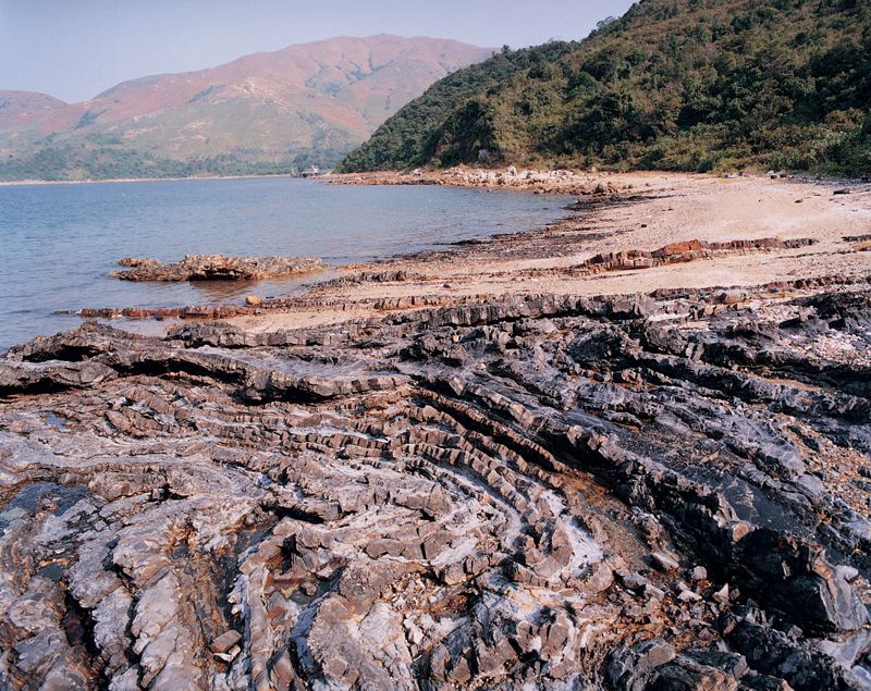
這是赤門海峽荔枝莊的一個史前火山湖的沉積岩。顏色和形態交織成色彩鮮艶的圖案。灰色的砂岩,深灰色的粉砂岩及橙色的火山岩被地殼運動的強大力量擠壓摺皺。
Ancient volcanic lake deposits at Lai Chi Chong, Tolo Channel, feature a kaleidoscopic pattern of colours and textures. The layers of grey sandstone, dark grey siltstone and orangish volcanic rock have been folded by post-depositional events.

荔枝莊薄層狀、深淺色相間的泥岩和砂岩。
Thin layers of light and dark coloured mudstone and sandstone at Lai Chi Chong.
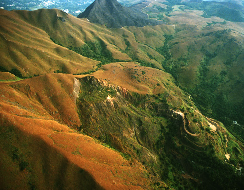
朝北方向遠眺針山,針山廢棄礦場位於照片正中偏左流入下城門水塘的山谷上,照片最遠處是大帽山。
View of Needle Hill looking north toward Tai Mo Shan. The former Needle Hill Mine workings are just visible in the centre left of the photograph, in a prominent valley draining into the Lower Shing Mun Reservoir.
赤門馬屎洲褐色風化殼將白色砂岩部份覆蓋。
A brown weathering crust partially covering white sandstone on Ma Shi Chau, Tolo Channel.
新界東北吐露港馬屎洲大埔海組地層,粉砂岩層面扭折帶構造發育極好。
Well-developed kink-bands in siltstone of the Tolo Harbour Formation, Ma Shi Chau, northeastern New Territories.
馬鞍山陡肖的季節性溝蝕河谷。
Steep, seasonal stream channels on Ma On Shan.
嶙峋的馬鞍山,山峰地層為堅固的火山岩。
The prominent angular peak of Ma On Shan, capped by resistant volcanic rock.
馬鞍山南面一帶山坡因為受探礦活動的影響,原來的山坡地貌已受到破壞。
View of the southern slopes of Ma On Shan showing the area of disturbed ground in the vicinity of the former Ma On Shan mine workings.
新界東北部執毛洲小島四周的海蝕平台。
Small island of Chap Mo Chau encircled by a wave-cut platform, northeastern New Territories.
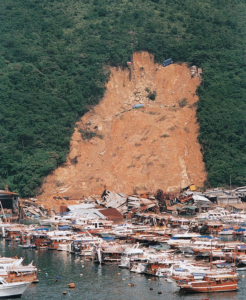
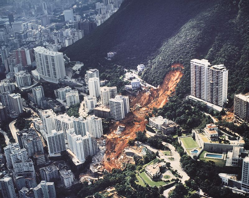
1995年8月13日香港島南部香港仔的深灣道滑坡。
Shum Wan Road landslide, Aberdeen, Hong Kong Island on 13th August, 1995.
香港島舂坎角花崗岩滾石上的斑點狀侵蝕面。
Pitted and fluted surfaces on granite boulders at Chung Hom Kok, Hong Kong Island.
新界東部的蚺蛇尖, 大量垂直節理切割火山岩的岩層。
Layers of volcanic rock cut by numerous vertical joints, Sharp Peak, eastern New Territories.
近萬宜水庫東壩的麥理浩徑,我們可以看到一系列的六邊形火山岩石柱。深灰色的岩牆是由於熔岩侵入摺曲岩層內的空隙而引致。
Walkers on the MacLehose Trail near the High Island East Dam will see these curved six-sided columns of volcanic rock. Bending created an opening for molten rock to enter forming a dyke (dark grey).
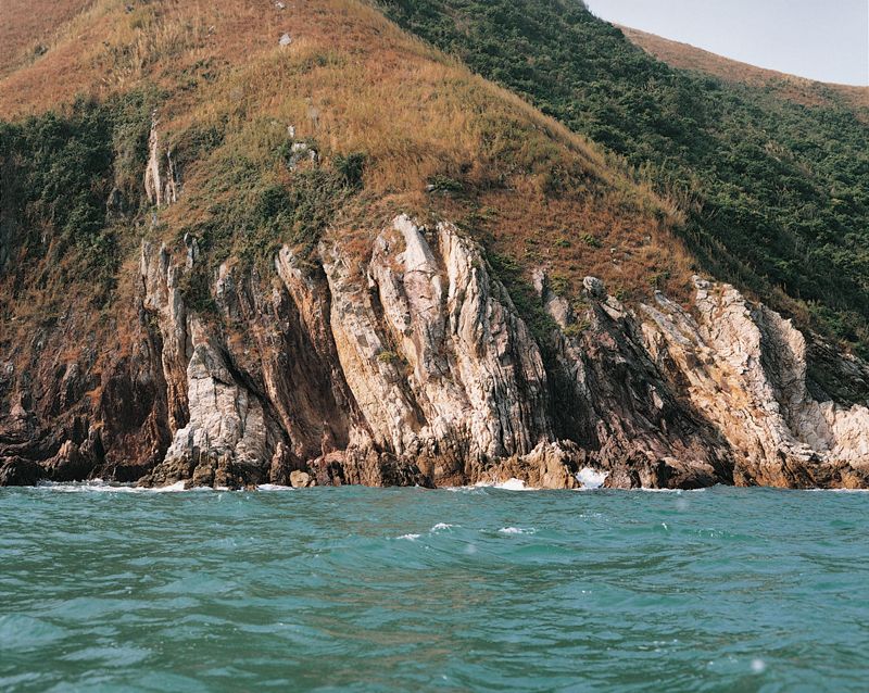
赤門海峽黃竹角咀的海蝕崖,是由傾斜至垂直的淺灰色砂岩和紅色泥岩組成。
Sea cliffs at Bluff Head, Tolo Channel, formed of steeply tilted layers of light grey sandstone and red mudstone.
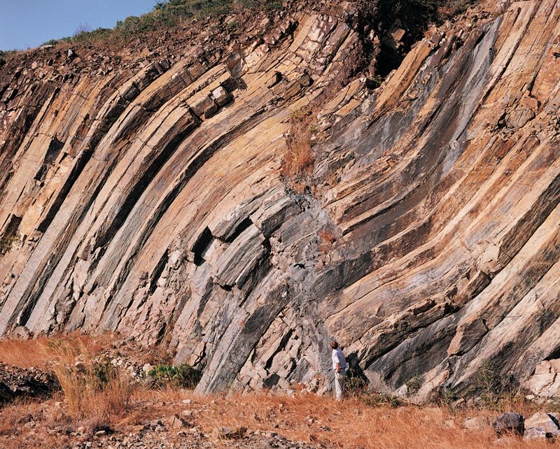
新界東北黃竹角咀摺皺的泥盆紀岩層。
Folded Devonian age rocks at Bluff Head, northeastern New Territories.
風雨侵蝕,萬古留痕,往往出人意表。這是新界東部滘西洲夾雜石隙的風化火山岩,看似古埃及石刻。
This may look like an ancient Egyptian stone-carving but actually contains the cores of irregularly shaped joint blocks of fresh rock exposed by weathering at Kau Sai Chau, eastern New Territories.
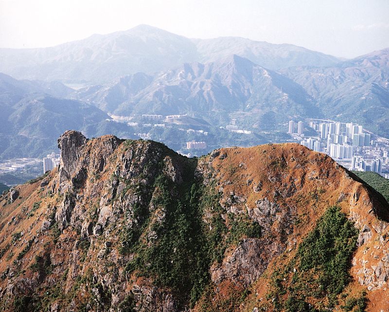
九龍北部的獅子山由堅硬花崗岩組成。
Lion Rock composed of resistant granite, north Kowloon.
在香港海域南部的蒲台島螺洲,矮崖上花崗岩出露幾組交錯的節理和一些平滑的節理面。
Intersecting joint sets and flat joint faces exposed in low granite cliffs on Beaufort Island, Po Toi Islands.

蒲台島上筆直豎立的花崗石柱,仿如單掌宣唸佛號之態。
Like the fingers of a praying hand, these granite slabs perch precariously on the top of Po Toi Island.
蒲台島大角頭沿兩組節理侵入的暗色岩牆。
A series of dark coloured dykes intruded along two joint sets at Tai Kok Tau, Po Toi Island.
蒲台花崗岩平板狀節理。
Slab-like sheet joints in the Po Toi Granite.
大嶼山南面鳳凰山下火山岩的巨礫。
Boulders of volcanic rock below Lantau Peak, southern Lantau Island.
大嶼山鳳凰山南側的小型滑坡。
Multiple landslides on the southern flank of Lantau Peak, Lautau Island.
赤門海峽鳳凰笏砂岩中彎曲的石英脈。
Curved quartz veins in sandstone at Fung Wong Wat, Tolo Channel.
鴨脷洲含綠灰色拉長浮石碎屑的火山岩近觀。
Close-up of a volcanic rock on Ap Lei Chau, containing elongate fragments of greenish grey pumice.

新界東北的鴨洲島上,海浪沖擊和帶走了輕微膠結的岩石,形成的景象看似恆古以來往海邊汲水的一頭巨獸。
What looks like a mammoth beast drinking from the sea off Ap Chau, Northeast New Territories, is in fact a natural arch eroded by the sea into a rock consisting of cobbles and boulders cemented together.
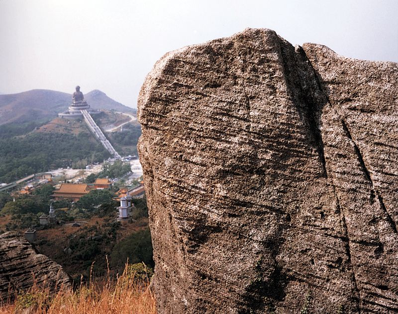
一億四千六百萬年前,大嶼山地區火山多次爆發,火山灰逐層堆積,形成了現今的彌勒山,遙望昂平大彿,大有「佛祖說法,頑石點頭」之勢。
A reverent volcanic rock pays homage to Buddha on Lantau. Thin layers of ash were deposited by eruptions from a volcano near Nei Lak Shan about 146 millon years ago.
1972年7月18日香港島半山區的寶珊道滑坡。
Po Shan Road landslide, Mid-levels, Hong Kong Island on 18th July, 1972.
大嶼山籮箕灣附近石英正長岩的圓滑岩塊。
Rounded quartz monzonite blocks near Lo Kei Wan, Lantau Island.