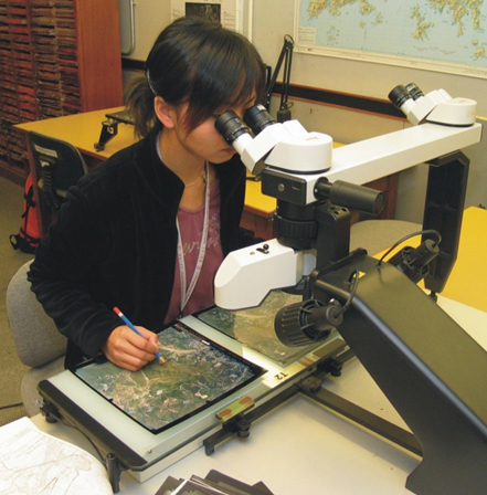
The GEO Aerial Photograph Library contains over 310,000 aerial photographs, both black and white, infrared and colour, dating back to 1924. They are borrowed on a regular basis by GEO staff as well as consultants working on Government projects. At any one time, about 20,000 photographs are out on loan.
The Geological Modelling System (GMS) is a Geographic Information System (GIS) for storage, integration, interpretation and presentation of Hong Kong-wide geological, geophysical and geotechnical data. Each of the data sets contributes to our knowledge and understanding of the rock and soil materials that underlie Hong Kong, the distribution of the materials, and the processes involved in their development. The system enables access to raw data, and current interpretations of data. New thematic maps can be generated from the data, i.e., by user-specified combinations of datasets and plotted at a range of scales. Non-database information and cartography is added using the CAD-system in the Division's Cartographic Unit (linked by network to the GMS). More sophisticated queries or analyses generate output that can portray geological or terrain models, factors that may influence planning zonation, geological hazard assessments and environmental conditions.
Data
The GMS holds four main categories of data:
- Planning Division regional surveys including: geology, geotechnical area studies, natural terrain landslide inventory, regional gravity and stream sediment geochemistry. These datasets have Hong Kong-wide coverage.
- Ground Investigation data (e.g. drillhole data, seismic profiles, magnetic field data). The Planning Division attempts to get Hong Kong-wide coverage, but development is shared with data-owners or other users.
- Project or site-specific data collected by Planning Division, usually for limited areas. Examples include mapping for forensic landslide studies, specific infrastructure development or other project related data.
- External datasets, for example: Lands Department base maps, satellite images, aerial photographs, and orthophotos etc).
Data usage
The data is mainly used within Planning Division for a variety of projects, for example:
- Stream sediment geochemical atlas
- Natural Terrain Landslide Studies
- Landslide studies
- Complex geology at Tung Chung
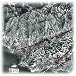
- Aerial photograph interpretation
Data availability
Planning Division's data is available to other users with permission of the Chief Geotechnical Engineer/Planning (though special conditions and restrictions apply). Users include other divisions in Civil Engineering and Development Department, other Government Departments, Government Corporations, Developers, Consultants, and Universities.