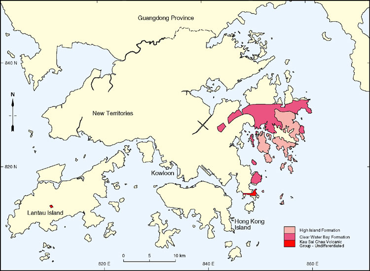
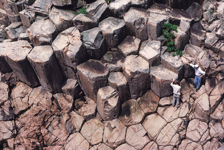
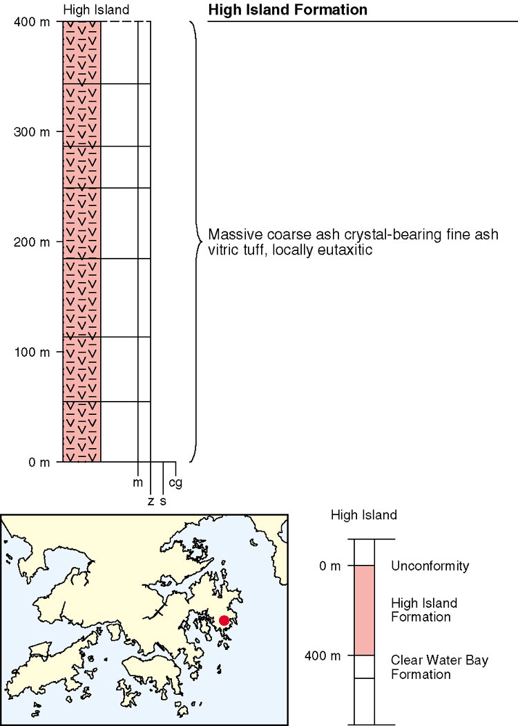
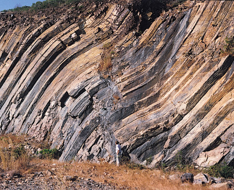
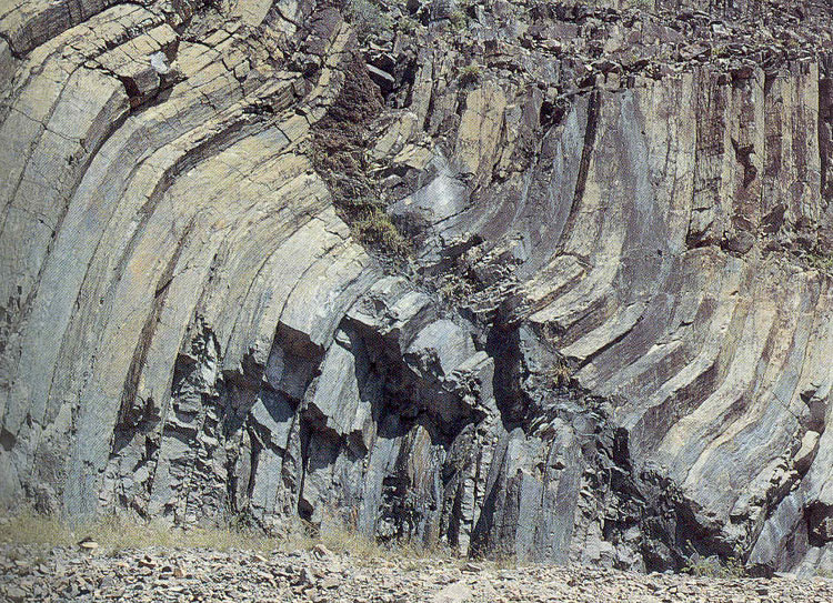
The High Island Formation (Table 5.7), which crops out in the Sai Kung and Clear Water Bay districts in eastern New Territories (Figure 5.24), is a very uniform, massive, crystal-bearing, fine ash vitric tuff with small-scale eutaxitic fabrics and spectacularly well-developed columnar jointing (Plates 5.11 & 5.34). The columnar joints can be seen to extend vertically for up to about 30 m in some places. The pyroclastic nature of these deposits was first recognized by Tam (1970).
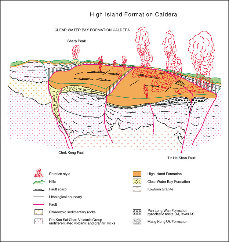
The formation unconformably overlies lavas, tuff and tuffite of the Clear Water Bay Formation and occurs principally as a widespread sheet, up to 400 m thick. The thickest development of the formation appears to be to the south of an inferred westerly-trending structure, passing through the High Island Reservoir and Sai Kung. The thickness variations suggest that the formation occupies a complex caldera (Figure 5.28). Although much of the formation probably developed as a single cooling unit, it appears to comprise several pyroclastic flow deposits (Figure 5.26). Mesoscale kink bands (Plate 9.13) may also have developed during the cooling and contraction of the tuffs.
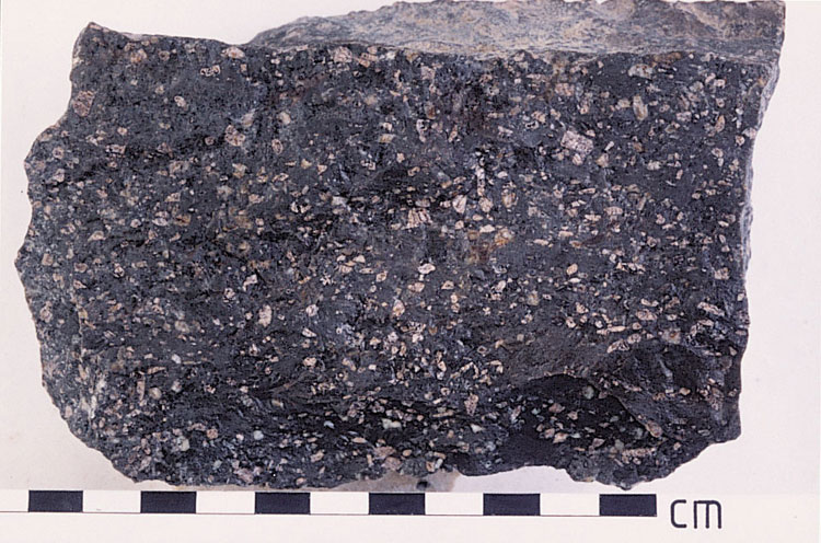
The formation is compositionally homogeneous with a high-silica rhyolite chemistry. The very fine-grained matrix contains c.20% of crystals dominated by small euhedral alkali feldspars, with some larger broken fragments of quartz and feldspar (Plate 5.35). High precision U–Pb dating of single zircon crystals has yielded an age of 140.9 ± 0.2 Ma for the formation (Davis et al., 1997).
Details
Port Shelter, Rocky Harbour, High Island and Sai Kung East Country Park. Apart from the smaller islands of Inner Port Shelter (Sai Kung Hoi), the area is composed mainly of High Island Formation fine ash vitric tuffs displaying columnar jointing. Faint eutaxitic fabrics and the attitude of the columns indicate fairly gentle dips in the strata, usually towards the east or southeast. Although the cliffs are sheer and rugged, inland the tuff produces a subdued, rounded topography, with valleys eroded along fracture traces which are particularly clear in aerial photographs.
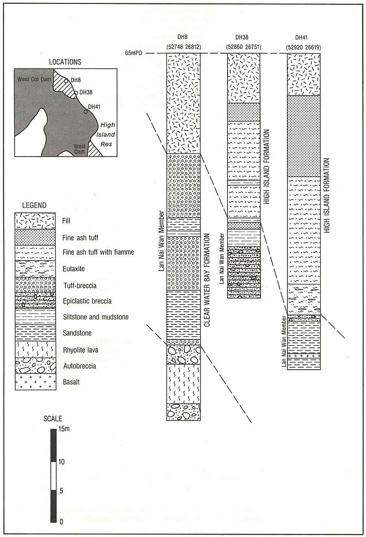
A number of boreholes sited at the High Island west col dam (852800 826700 Kkh-1) have proved the basal part of the High Island Formation. In borehole DH41 (852920 826619 Kkh-2), 42.5 m of the formation rest on epiclastic breccia, tuffaceous siltstone and sandstone of the Lan Nai Wan Member (Clear Water Bay Formation). A small-scale eutaxitic fabric in the fine ash vitric tuff is present in the lower part of the sequence, and this grades into eutaxite with abundant prominent fiammee in the basal few metres (Figure 5.A6). Small tabular feldspar crystals and quartz crystals are scattered throughout the cores, and in places crystal concentrations were noted.
Spectacular columnar jointing is seen in the area of the east dam (Plate 5.A34), with hexagonal columns averaging 1 to 2 m in diameter and extending to depths of at least 80 m. Fiamme lying parallel to the column base, indicate a gentle dip to the southeast. Some kinking of the columns may represent differential laminar shearing associated with post-depositional secondary flow structure.
Along the northern shores of the High Island Reservoir the typical columnar jointed fine ash vitric tuff is well-exposed with fiamme frequently visible on the slightly weathered rock surfaces. In the valleys to the west of Sai Wan the underlying Clear Water Bay Formation is seen as inliers beneath uniform fine ash tuff of the High Island Formation. Southward dipping fine ash tuff forms the summit of Tai Mun Shan (855600 830700 Kkh-3), and to the south of Chek Keng a faulted block of the formation occupies the high ground.
To the northeast, on the opposite side of the the High Island west col dam (853820 827040 Kkh-4), pale grey tuffite with green sandstone bands is exposed 25 m below the high water level. Banded green mudstone underlies the massive High Island tuffs 1200 m west of Sai Wan Village (854980 828200 Kkh-5).
The High Island Formation is present along the valley floors to the west of Sai Wan, the largest outcrop being in the vicinity of Luk Wu (855000 829200 Kkh-6) where flow-banded red and purple lava is exposed in the stream bed. Similar exposures were noted below the high water level on the northern side of the High Island Reservoir, 1.5 m southwest of Sai Wan (854850 827380 Kkh-7, 854970 827960 Kkh-8).
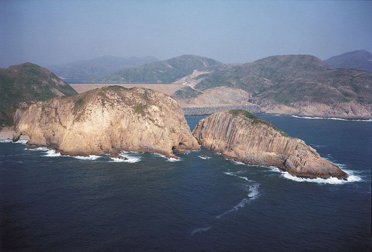
Ninepins Group. The Ninepin Islands, Ching Chau (850400 815300 Kkh-9), and the smaller islands to the east of the Clear Water Bay Peninsula are entirely in the High Island Formation. The Ninepins, in particular, display spectacular columnar jointing in the cliff sections.