The Planning Division is one of the two divisions of the Planning and Standards Branch within the Geotechnical Engineering Office of the Civil Engineering and Development Department. The Division is managed by a Chief Geotechnical Engineer and is consisted of about 50 professional, technical, and administration staff distributed among five Sections, a General Registry, and the Civil Engineering Library. The general organisational structure of the Division in relation to the Standards and Testing Division is outlined below.
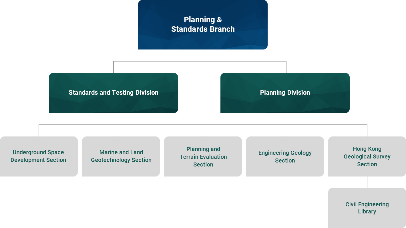
The Hong Kong Geological Survey (GS) Section, which houses the Hong Kong Geological Survey, is responsible for geological mapping, geological reporting, the archiving of geological information, and the provision of geological advice to the Government, the private sector, and the general public. The HKGS also provides the geological input to GEO's mission to improve slope safety, including the mapping of selected major landslides, investigations of geological features influencing slope stability and the dating of relict natural terrain landslides. Various geophysical surveys have been commissioned to elucidate subsurface geological structures and a regional geochemical stream sediment survey has been employed to the background levels of a variety of chemical elements.The GS Section is responsible for managing the CEDD Civil Engineering Library.
The Engineering Geology (EG) Section provides engineering geological input to landslide investigations and studies on government development projects. The Section also provides support on natural terrain hazard studies for land sale sites and development sites. The EG Section manages Landslip Prevention and Mitigation Programme Consultancy Agreements for natural hillside catchments and project administration of associated works contracts. This includes instrumentation and bioengineering works at selected sites in west Lantau. We also provide technical support to strategic technical and planning studies related to rock cavern development in Hong Kong.
The Planning and Terrain Evaluation (PTE) Section provides input into the Government's land planning system by reviewing the geotechnical feasibility of planning proposals and providing advice for better land planning and utilization. The PTE Section is responsible for managing Aerial Photograph Library. The PTE Section is also actively involved in the development of a computerised geographic information system known as the Geological Modelling System, and applications of different remote sensing techniques, such as airborne Light Detection and Ranging (LiDAR) and mobile laser scanning, to assist acquisition of high resolution geospatial data for natural terrain hazard studies.
The Marine and Land Geotechnology (MG) Section provides comments on soft soil engineering for reclamation projects and technical supports and geotechnology development works on natural terrain hazard relates subjects. The MG Section also undertakes a feasibility study of the long-term strategy for cavern development in Hong Kong and a territory-wide feasibility study on underground space development in the urban areas of Hong Kong.
The Underground Space Development (UD) Section provides input to promote enhanced use of underground space in urban areas of Hong Kong. The UD Section is carrying out a pilot study on underground space development covering four selected strategic areas, namely Tsim Sha Tsui West, Causeway Bay, Happy Valley and Admiralty/Wan Chai.